
NWAO Narrogin, Australia - Earthquake Result Viewer
| ||||||||||||||||||
| ||||||||||||||||||
| ||||||||||||||||||
|
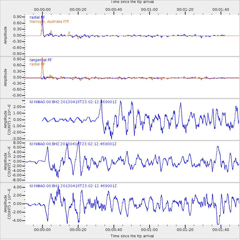
Signal To Noise
| Channel | StoN | STA | LTA |
| IU:NWAO:00:BHZ:20130416T23:02:12.469001Z | 10.996201 | 2.6180173E-6 | 2.3808381E-7 |
| IU:NWAO:00:BH1:20130416T23:02:12.469001Z | 12.048796 | 1.6986571E-6 | 1.4098148E-7 |
| IU:NWAO:00:BH2:20130416T23:02:12.469001Z | 6.8647695 | 1.3295385E-6 | 1.9367563E-7 |
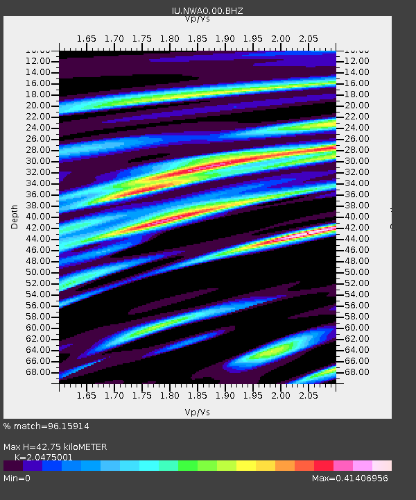
| Arrivals | |
| Ps | 7.4 SECOND |
| PpPs | 19 SECOND |
| PsPs/PpSs | 26 SECOND |

