You are here: Home > Network List > CN - Canadian National Seismograph Network Stations List
> Station INK INUVIK, NT > Earthquake Result Viewer
INK INUVIK, NT - Earthquake Result Viewer
*The percent match for this event was below the threshold and hence no stack was calculated.
| Earthquake location: |
Southwestern Pakistan |
| Earthquake latitude/longitude: |
28.1/62.4 |
| Earthquake time(UTC): |
2013/04/17 (107) 03:15:52 GMT |
| Earthquake Depth: |
56 km |
| Earthquake Magnitude: |
5.6 MW, 5.6 MW, 5.7 MB |
| Earthquake Catalog/Contributor: |
NEIC PDE/NEIC PDE-W |
|
| Network: |
CN Canadian National Seismograph Network |
| Station: |
INK INUVIK, NT |
| Lat/Lon: |
68.31 N/133.53 W |
| Elevation: |
44 m |
|
| Distance: |
83.1 deg |
| Az: |
5.881 deg |
| Baz: |
345.911 deg |
| Ray Param: |
$rayparam |
*The percent match for this event was below the threshold and hence was not used in the summary stack. |
|
| Radial Match: |
44.500782 % |
| Radial Bump: |
400 |
| Transverse Match: |
53.840332 % |
| Transverse Bump: |
400 |
| SOD ConfigId: |
512894 |
| Insert Time: |
2013-09-13 08:01:07.398 +0000 |
| GWidth: |
2.5 |
| Max Bumps: |
400 |
| Tol: |
0.001 |
|
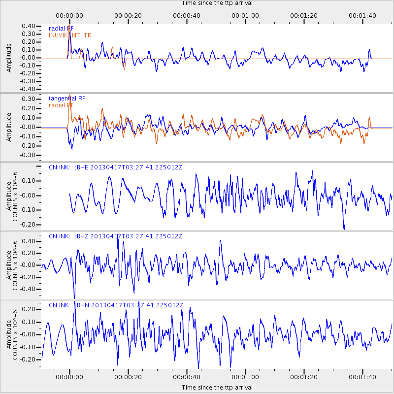
Signal To Noise
| Channel | StoN | STA | LTA |
| CN:INK: :BHZ:20130417T03:27:41.225012Z | 3.2887511 | 1.9785156E-7 | 6.016009E-8 |
| CN:INK: :BHN:20130417T03:27:41.225012Z | 1.3645597 | 1.1388752E-7 | 8.3461E-8 |
| CN:INK: :BHE:20130417T03:27:41.225012Z | 1.2134366 | 8.381086E-8 | 6.9069E-8 |
| Arrivals |
| Ps | |
| PpPs | |
| PsPs/PpSs | |


