You are here: Home > Network List > G - GEOSCOPE Stations List
> Station TAM Tamanrasset, Algeria > Earthquake Result Viewer
TAM Tamanrasset, Algeria - Earthquake Result Viewer
*The percent match for this event was below the threshold and hence no stack was calculated.
| Earthquake location: |
Southwestern Pakistan |
| Earthquake latitude/longitude: |
28.1/62.4 |
| Earthquake time(UTC): |
2013/04/17 (107) 03:15:52 GMT |
| Earthquake Depth: |
56 km |
| Earthquake Magnitude: |
5.6 MW, 5.6 MW, 5.7 MB |
| Earthquake Catalog/Contributor: |
NEIC PDE/NEIC PDE-W |
|
| Network: |
G GEOSCOPE |
| Station: |
TAM Tamanrasset, Algeria |
| Lat/Lon: |
22.79 N/5.53 E |
| Elevation: |
1377 m |
|
| Distance: |
51.2 deg |
| Az: |
277.633 deg |
| Baz: |
71.566 deg |
| Ray Param: |
$rayparam |
*The percent match for this event was below the threshold and hence was not used in the summary stack. |
|
| Radial Match: |
66.98327 % |
| Radial Bump: |
400 |
| Transverse Match: |
61.137955 % |
| Transverse Bump: |
400 |
| SOD ConfigId: |
512894 |
| Insert Time: |
2013-09-13 08:02:47.053 +0000 |
| GWidth: |
2.5 |
| Max Bumps: |
400 |
| Tol: |
0.001 |
|
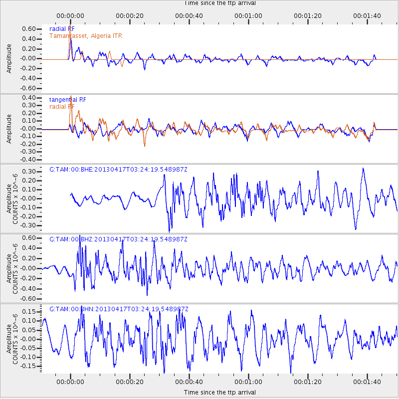
Signal To Noise
| Channel | StoN | STA | LTA |
| G:TAM:00:BHZ:20130417T03:24:19.548987Z | 3.6095774 | 2.5982314E-7 | 7.1981596E-8 |
| G:TAM:00:BHN:20130417T03:24:19.548987Z | 1.5928593 | 8.679455E-8 | 5.448978E-8 |
| G:TAM:00:BHE:20130417T03:24:19.548987Z | 4.0504193 | 1.7608103E-7 | 4.3472298E-8 |
| Arrivals |
| Ps | |
| PpPs | |
| PsPs/PpSs | |


