You are here: Home > Network List > II - Global Seismograph Network (GSN - IRIS/IDA) Stations List
> Station WRAB Tennant Creek, NT, Australia > Earthquake Result Viewer
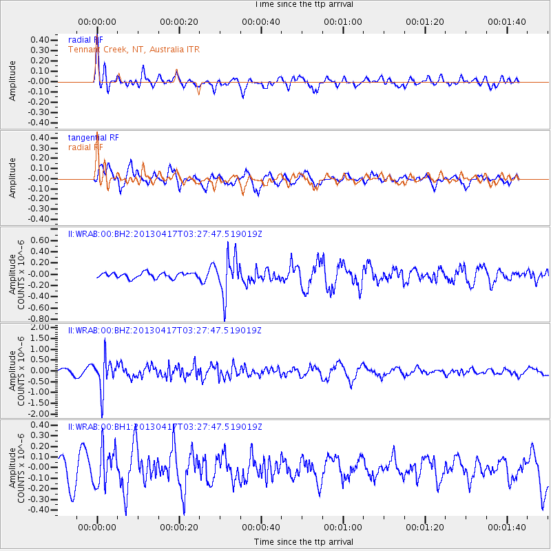
WRAB Tennant Creek, NT, Australia - Earthquake Result Viewer
*The percent match for this event was below the threshold and hence no stack was calculated.
| Earthquake location: |
Southwestern Pakistan |
| Earthquake latitude/longitude: |
28.1/62.4 |
| Earthquake time(UTC): |
2013/04/17 (107) 03:15:52 GMT |
| Earthquake Depth: |
56 km |
| Earthquake Magnitude: |
5.6 MW, 5.6 MW, 5.7 MB |
| Earthquake Catalog/Contributor: |
NEIC PDE/NEIC PDE-W |
|
| Network: |
II Global Seismograph Network (GSN - IRIS/IDA) |
| Station: |
WRAB Tennant Creek, NT, Australia |
| Lat/Lon: |
19.93 S/134.36 E |
| Elevation: |
366 m |
|
| Distance: |
84.4 deg |
| Az: |
115.958 deg |
| Baz: |
302.417 deg |
| Ray Param: |
$rayparam |
*The percent match for this event was below the threshold and hence was not used in the summary stack. |
|
| Radial Match: |
66.34511 % |
| Radial Bump: |
400 |
| Transverse Match: |
74.19155 % |
| Transverse Bump: |
400 |
| SOD ConfigId: |
512894 |
| Insert Time: |
2013-09-13 08:05:03.674 +0000 |
| GWidth: |
2.5 |
| Max Bumps: |
400 |
| Tol: |
0.001 |
|
Signal To Noise
| Channel | StoN | STA | LTA |
| II:WRAB:00:BHZ:20130417T03:27:47.519019Z | 5.624861 | 7.3114023E-7 | 1.299837E-7 |
| II:WRAB:00:BH1:20130417T03:27:47.519019Z | 1.5963036 | 1.7852426E-7 | 1.1183604E-7 |
| II:WRAB:00:BH2:20130417T03:27:47.519019Z | 7.363239 | 3.391288E-7 | 4.6057018E-8 |
| Arrivals |
| Ps | |
| PpPs | |
| PsPs/PpSs | |


