You are here: Home > Network List > TA - USArray Transportable Network (new EarthScope stations) Stations List
> Station I55A Frankford, ON, CAN > Earthquake Result Viewer
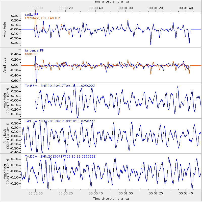
I55A Frankford, ON, CAN - Earthquake Result Viewer
*The percent match for this event was below the threshold and hence no stack was calculated.
| Earthquake location: |
Near S. Coast Of Honshu, Japan |
| Earthquake latitude/longitude: |
34.1/139.4 |
| Earthquake time(UTC): |
2013/04/17 (107) 08:57:19 GMT |
| Earthquake Depth: |
11 km |
| Earthquake Magnitude: |
5.8 MW |
| Earthquake Catalog/Contributor: |
NEIC PDE/NEIC PDE-W |
|
| Network: |
TA USArray Transportable Network (new EarthScope stations) |
| Station: |
I55A Frankford, ON, CAN |
| Lat/Lon: |
44.22 N/77.68 W |
| Elevation: |
132 m |
|
| Distance: |
95.1 deg |
| Az: |
25.779 deg |
| Baz: |
329.86 deg |
| Ray Param: |
$rayparam |
*The percent match for this event was below the threshold and hence was not used in the summary stack. |
|
| Radial Match: |
52.9802 % |
| Radial Bump: |
400 |
| Transverse Match: |
58.962513 % |
| Transverse Bump: |
400 |
| SOD ConfigId: |
512894 |
| Insert Time: |
2013-09-13 08:49:13.007 +0000 |
| GWidth: |
2.5 |
| Max Bumps: |
400 |
| Tol: |
0.001 |
|
Signal To Noise
| Channel | StoN | STA | LTA |
| TA:I55A: :BHZ:20130417T09:10:11.025022Z | 2.420656 | 2.8874453E-7 | 1.1928358E-7 |
| TA:I55A: :BHN:20130417T09:10:11.025022Z | 0.8388823 | 1.1491655E-7 | 1.369877E-7 |
| TA:I55A: :BHE:20130417T09:10:11.025022Z | 1.3511887 | 1.5752508E-7 | 1.165826E-7 |
| Arrivals |
| Ps | |
| PpPs | |
| PsPs/PpSs | |


