You are here: Home > Network List > AV - Alaska Volcano Observatory Stations List
> Station AMKA Regional Station, Amchitka Island, Alaska > Earthquake Result Viewer
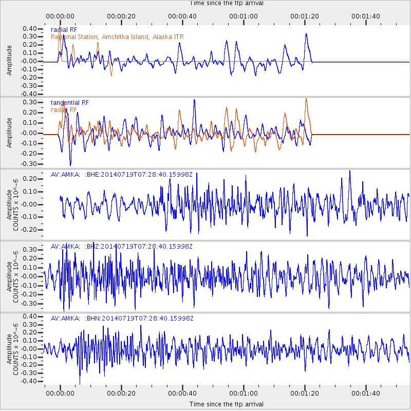
AMKA Regional Station, Amchitka Island, Alaska - Earthquake Result Viewer
*The percent match for this event was below the threshold and hence no stack was calculated.
| Earthquake location: |
Afghanistan-Tajikistan Bord Reg. |
| Earthquake latitude/longitude: |
36.9/71.1 |
| Earthquake time(UTC): |
2014/07/19 (200) 07:17:56 GMT |
| Earthquake Depth: |
84 km |
| Earthquake Magnitude: |
5.3 MW, 5.2 Mwb, 5.3 mb |
| Earthquake Catalog/Contributor: |
ISC/ISC |
|
| Network: |
AV Alaska Volcano Observatory |
| Station: |
AMKA Regional Station, Amchitka Island, Alaska |
| Lat/Lon: |
51.38 N/179.30 E |
| Elevation: |
116 m |
|
| Distance: |
72.0 deg |
| Az: |
38.75 deg |
| Baz: |
306.793 deg |
| Ray Param: |
$rayparam |
*The percent match for this event was below the threshold and hence was not used in the summary stack. |
|
| Radial Match: |
56.730953 % |
| Radial Bump: |
400 |
| Transverse Match: |
62.303673 % |
| Transverse Bump: |
400 |
| SOD ConfigId: |
3390531 |
| Insert Time: |
2019-04-12 23:01:24.902 +0000 |
| GWidth: |
2.5 |
| Max Bumps: |
400 |
| Tol: |
0.001 |
|
Signal To Noise
| Channel | StoN | STA | LTA |
| AV:AMKA: :BHZ:20140719T07:28:40.15998Z | 3.0412903 | 1.7657293E-7 | 5.8058557E-8 |
| AV:AMKA: :BHN:20140719T07:28:40.15998Z | 0.7944169 | 6.3934145E-8 | 8.047934E-8 |
| AV:AMKA: :BHE:20140719T07:28:40.15998Z | 1.2857866 | 7.0882855E-8 | 5.512801E-8 |
| Arrivals |
| Ps | |
| PpPs | |
| PsPs/PpSs | |


