You are here: Home > Network List > TA - USArray Transportable Network (new EarthScope stations) Stations List
> Station G43A Wallace, MI, USA > Earthquake Result Viewer
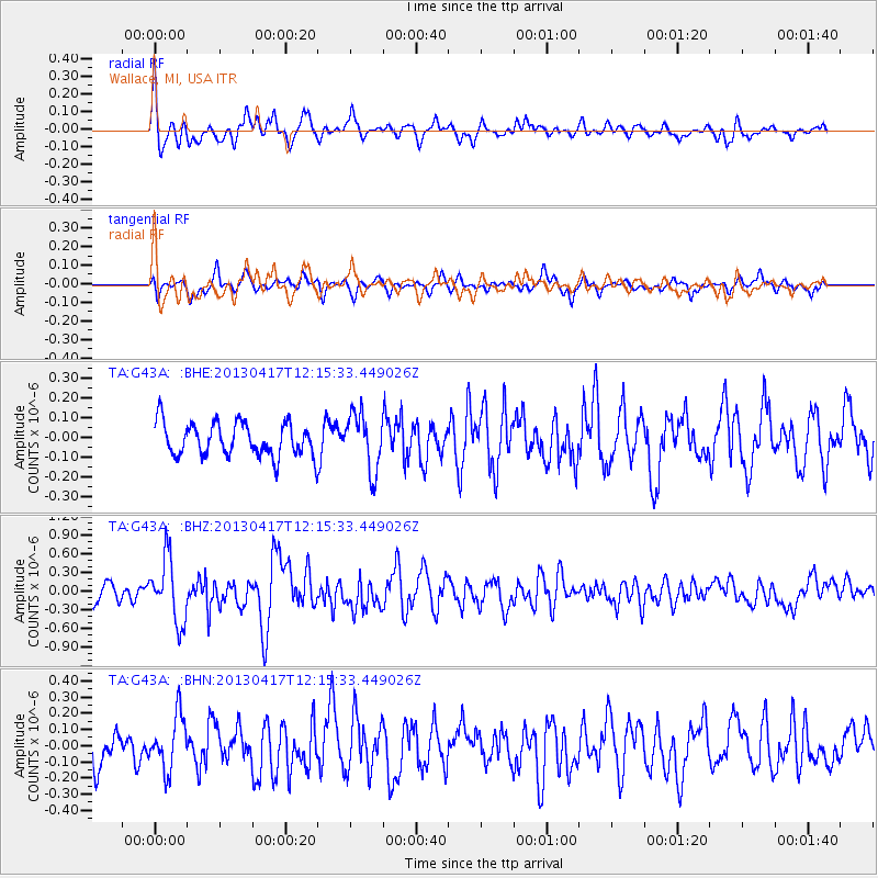
G43A Wallace, MI, USA - Earthquake Result Viewer
*The percent match for this event was below the threshold and hence no stack was calculated.
| Earthquake location: |
Near East Coast Of Honshu, Japan |
| Earthquake latitude/longitude: |
38.5/141.6 |
| Earthquake time(UTC): |
2013/04/17 (107) 12:03:31 GMT |
| Earthquake Depth: |
50 km |
| Earthquake Magnitude: |
5.9 MW, 5.7 MB, 6.0 MW |
| Earthquake Catalog/Contributor: |
NEIC PDE/NEIC PDE-W |
|
| Network: |
TA USArray Transportable Network (new EarthScope stations) |
| Station: |
G43A Wallace, MI, USA |
| Lat/Lon: |
45.26 N/87.69 W |
| Elevation: |
213 m |
|
| Distance: |
85.6 deg |
| Az: |
32.494 deg |
| Baz: |
323.345 deg |
| Ray Param: |
$rayparam |
*The percent match for this event was below the threshold and hence was not used in the summary stack. |
|
| Radial Match: |
69.60828 % |
| Radial Bump: |
400 |
| Transverse Match: |
58.24445 % |
| Transverse Bump: |
399 |
| SOD ConfigId: |
512894 |
| Insert Time: |
2013-09-13 09:35:10.334 +0000 |
| GWidth: |
2.5 |
| Max Bumps: |
400 |
| Tol: |
0.001 |
|
Signal To Noise
| Channel | StoN | STA | LTA |
| TA:G43A: :BHZ:20130417T12:15:33.449026Z | 3.6330352 | 5.135641E-7 | 1.4135951E-7 |
| TA:G43A: :BHN:20130417T12:15:33.449026Z | 1.4338375 | 1.6638099E-7 | 1.1603894E-7 |
| TA:G43A: :BHE:20130417T12:15:33.449026Z | 1.693849 | 1.4119784E-7 | 8.335916E-8 |
| Arrivals |
| Ps | |
| PpPs | |
| PsPs/PpSs | |


