You are here: Home > Network List > US - United States National Seismic Network Stations List
> Station ELK Elko, Nevada, USA > Earthquake Result Viewer
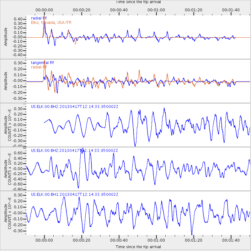
ELK Elko, Nevada, USA - Earthquake Result Viewer
*The percent match for this event was below the threshold and hence no stack was calculated.
| Earthquake location: |
Near East Coast Of Honshu, Japan |
| Earthquake latitude/longitude: |
38.5/141.6 |
| Earthquake time(UTC): |
2013/04/17 (107) 12:03:31 GMT |
| Earthquake Depth: |
50 km |
| Earthquake Magnitude: |
5.9 MW, 5.7 MB, 6.0 MW |
| Earthquake Catalog/Contributor: |
NEIC PDE/NEIC PDE-W |
|
| Network: |
US United States National Seismic Network |
| Station: |
ELK Elko, Nevada, USA |
| Lat/Lon: |
40.74 N/115.24 W |
| Elevation: |
2210 m |
|
| Distance: |
74.5 deg |
| Az: |
50.163 deg |
| Baz: |
307.508 deg |
| Ray Param: |
$rayparam |
*The percent match for this event was below the threshold and hence was not used in the summary stack. |
|
| Radial Match: |
72.09753 % |
| Radial Bump: |
335 |
| Transverse Match: |
60.151752 % |
| Transverse Bump: |
336 |
| SOD ConfigId: |
512894 |
| Insert Time: |
2013-09-13 09:50:40.342 +0000 |
| GWidth: |
2.5 |
| Max Bumps: |
400 |
| Tol: |
0.001 |
|
Signal To Noise
| Channel | StoN | STA | LTA |
| US:ELK:00:BHZ:20130417T12:14:33.950002Z | 1.6466908 | 1.999353E-7 | 1.2141642E-7 |
| US:ELK:00:BH1:20130417T12:14:33.950002Z | 0.6369397 | 6.305329E-8 | 9.899413E-8 |
| US:ELK:00:BH2:20130417T12:14:33.950002Z | 0.9919385 | 1.03043234E-7 | 1.0388067E-7 |
| Arrivals |
| Ps | |
| PpPs | |
| PsPs/PpSs | |


