You are here: Home > Network List > US - United States National Seismic Network Stations List
> Station MNTX Cornudas Mountains, Texas, USA > Earthquake Result Viewer
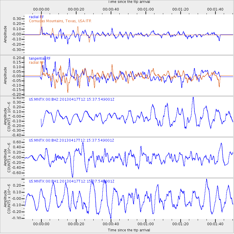
MNTX Cornudas Mountains, Texas, USA - Earthquake Result Viewer
*The percent match for this event was below the threshold and hence no stack was calculated.
| Earthquake location: |
Near East Coast Of Honshu, Japan |
| Earthquake latitude/longitude: |
38.5/141.6 |
| Earthquake time(UTC): |
2013/04/17 (107) 12:03:31 GMT |
| Earthquake Depth: |
50 km |
| Earthquake Magnitude: |
5.9 MW, 5.7 MB, 6.0 MW |
| Earthquake Catalog/Contributor: |
NEIC PDE/NEIC PDE-W |
|
| Network: |
US United States National Seismic Network |
| Station: |
MNTX Cornudas Mountains, Texas, USA |
| Lat/Lon: |
31.70 N/105.38 W |
| Elevation: |
404 m |
|
| Distance: |
86.4 deg |
| Az: |
51.837 deg |
| Baz: |
313.614 deg |
| Ray Param: |
$rayparam |
*The percent match for this event was below the threshold and hence was not used in the summary stack. |
|
| Radial Match: |
38.12716 % |
| Radial Bump: |
349 |
| Transverse Match: |
69.84056 % |
| Transverse Bump: |
400 |
| SOD ConfigId: |
512894 |
| Insert Time: |
2013-09-13 09:51:29.269 +0000 |
| GWidth: |
2.5 |
| Max Bumps: |
400 |
| Tol: |
0.001 |
|
Signal To Noise
| Channel | StoN | STA | LTA |
| US:MNTX:00:BHZ:20130417T12:15:37.549001Z | 2.6193092 | 1.8422412E-7 | 7.0333094E-8 |
| US:MNTX:00:BH1:20130417T12:15:37.549001Z | 1.755556 | 1.2129951E-7 | 6.909464E-8 |
| US:MNTX:00:BH2:20130417T12:15:37.549001Z | 0.61989343 | 5.44593E-8 | 8.785268E-8 |
| Arrivals |
| Ps | |
| PpPs | |
| PsPs/PpSs | |


