You are here: Home > Network List > TJ - Tajikistan National Seismic Network Stations List
> Station GARM Garm, Tajikistan > Earthquake Result Viewer
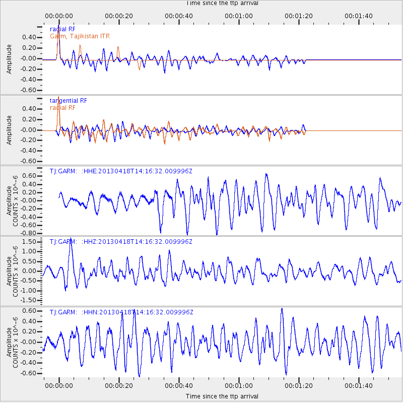
GARM Garm, Tajikistan - Earthquake Result Viewer
*The percent match for this event was below the threshold and hence no stack was calculated.
| Earthquake location: |
Southwestern Ryukyu Isl., Japan |
| Earthquake latitude/longitude: |
24.9/123.4 |
| Earthquake time(UTC): |
2013/04/18 (108) 14:08:35 GMT |
| Earthquake Depth: |
10 km |
| Earthquake Magnitude: |
5.5 MW |
| Earthquake Catalog/Contributor: |
NEIC PDE/NEIC PDE-W |
|
| Network: |
TJ Tajikistan National Seismic Network |
| Station: |
GARM Garm, Tajikistan |
| Lat/Lon: |
39.00 N/70.32 E |
| Elevation: |
1305 m |
|
| Distance: |
46.5 deg |
| Az: |
300.906 deg |
| Baz: |
91.232 deg |
| Ray Param: |
$rayparam |
*The percent match for this event was below the threshold and hence was not used in the summary stack. |
|
| Radial Match: |
73.863205 % |
| Radial Bump: |
400 |
| Transverse Match: |
68.328835 % |
| Transverse Bump: |
400 |
| SOD ConfigId: |
512894 |
| Insert Time: |
2013-09-13 10:13:26.178 +0000 |
| GWidth: |
2.5 |
| Max Bumps: |
400 |
| Tol: |
0.001 |
|
Signal To Noise
| Channel | StoN | STA | LTA |
| TJ:GARM: :HHZ:20130418T14:16:32.009996Z | 4.297503 | 7.22436E-7 | 1.68106E-7 |
| TJ:GARM: :HHN:20130418T14:16:32.009996Z | 1.3826549 | 1.6738475E-7 | 1.2106041E-7 |
| TJ:GARM: :HHE:20130418T14:16:32.009996Z | 2.2412493 | 2.933447E-7 | 1.3088446E-7 |
| Arrivals |
| Ps | |
| PpPs | |
| PsPs/PpSs | |


