You are here: Home > Network List > TA - USArray Transportable Network (new EarthScope stations) Stations List
> Station O03E Paynes Creek, CA, USA > Earthquake Result Viewer
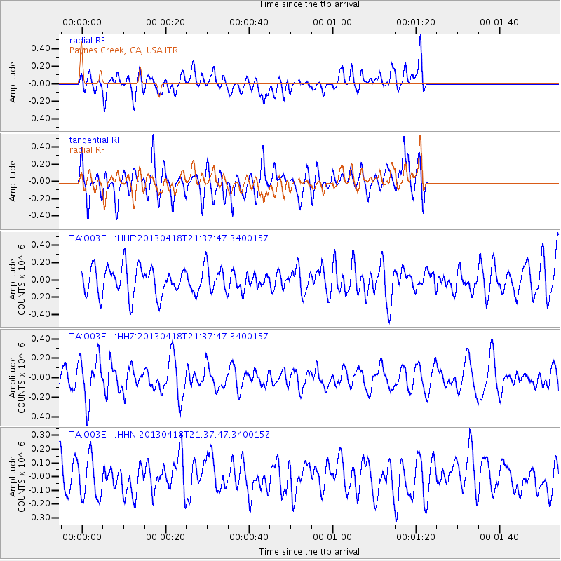
O03E Paynes Creek, CA, USA - Earthquake Result Viewer
*The percent match for this event was below the threshold and hence no stack was calculated.
| Earthquake location: |
Southern East Pacific Rise |
| Earthquake latitude/longitude: |
-34.3/-109.2 |
| Earthquake time(UTC): |
2013/04/18 (108) 21:26:36 GMT |
| Earthquake Depth: |
10 km |
| Earthquake Magnitude: |
5.5 MW |
| Earthquake Catalog/Contributor: |
NEIC PDE/NEIC PDE-W |
|
| Network: |
TA USArray Transportable Network (new EarthScope stations) |
| Station: |
O03E Paynes Creek, CA, USA |
| Lat/Lon: |
40.29 N/121.80 W |
| Elevation: |
967 m |
|
| Distance: |
75.2 deg |
| Az: |
350.07 deg |
| Baz: |
169.248 deg |
| Ray Param: |
$rayparam |
*The percent match for this event was below the threshold and hence was not used in the summary stack. |
|
| Radial Match: |
50.270172 % |
| Radial Bump: |
400 |
| Transverse Match: |
63.06836 % |
| Transverse Bump: |
400 |
| SOD ConfigId: |
512894 |
| Insert Time: |
2013-09-13 10:43:29.876 +0000 |
| GWidth: |
2.5 |
| Max Bumps: |
400 |
| Tol: |
0.001 |
|
Signal To Noise
| Channel | StoN | STA | LTA |
| TA:O03E: :HHZ:20130418T21:37:47.340015Z | 1.845933 | 2.3210148E-7 | 1.2573668E-7 |
| TA:O03E: :HHN:20130418T21:37:47.340015Z | 1.1726396 | 1.4905223E-7 | 1.271083E-7 |
| TA:O03E: :HHE:20130418T21:37:47.340015Z | 0.94329697 | 1.5232129E-7 | 1.6147756E-7 |
| Arrivals |
| Ps | |
| PpPs | |
| PsPs/PpSs | |


