You are here: Home > Network List > TA - USArray Transportable Network (new EarthScope stations) Stations List
> Station O47A Sheridan, IN, USA > Earthquake Result Viewer
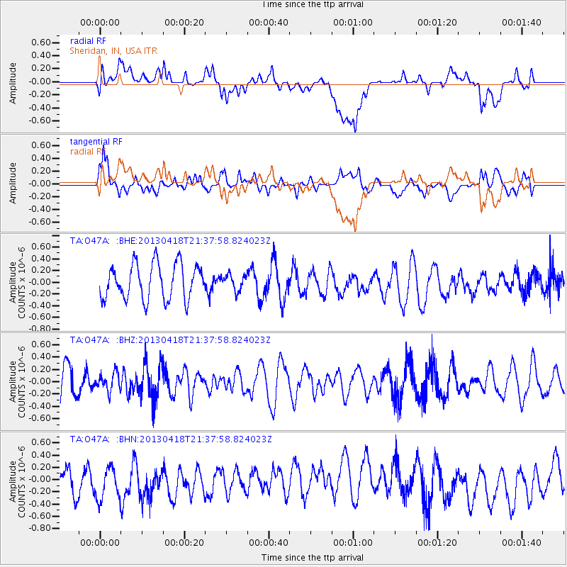
O47A Sheridan, IN, USA - Earthquake Result Viewer
*The percent match for this event was below the threshold and hence no stack was calculated.
| Earthquake location: |
Southern East Pacific Rise |
| Earthquake latitude/longitude: |
-34.3/-109.2 |
| Earthquake time(UTC): |
2013/04/18 (108) 21:26:36 GMT |
| Earthquake Depth: |
10 km |
| Earthquake Magnitude: |
5.5 MW |
| Earthquake Catalog/Contributor: |
NEIC PDE/NEIC PDE-W |
|
| Network: |
TA USArray Transportable Network (new EarthScope stations) |
| Station: |
O47A Sheridan, IN, USA |
| Lat/Lon: |
40.24 N/86.17 W |
| Elevation: |
278 m |
|
| Distance: |
77.2 deg |
| Az: |
17.892 deg |
| Baz: |
199.395 deg |
| Ray Param: |
$rayparam |
*The percent match for this event was below the threshold and hence was not used in the summary stack. |
|
| Radial Match: |
27.956789 % |
| Radial Bump: |
400 |
| Transverse Match: |
48.257202 % |
| Transverse Bump: |
400 |
| SOD ConfigId: |
512894 |
| Insert Time: |
2013-09-13 10:43:39.369 +0000 |
| GWidth: |
2.5 |
| Max Bumps: |
400 |
| Tol: |
0.001 |
|
Signal To Noise
| Channel | StoN | STA | LTA |
| TA:O47A: :BHZ:20130418T21:37:58.824023Z | 0.47907278 | 1.4652794E-7 | 3.0585736E-7 |
| TA:O47A: :BHN:20130418T21:37:58.824023Z | 0.88026583 | 4.5703146E-7 | 5.191971E-7 |
| TA:O47A: :BHE:20130418T21:37:58.824023Z | 0.44500065 | 1.3370571E-7 | 3.0046183E-7 |
| Arrivals |
| Ps | |
| PpPs | |
| PsPs/PpSs | |


