You are here: Home > Network List > TA - USArray Transportable Network (new EarthScope stations) Stations List
> Station S57A Dark Hollow, Roseland, VA, USA > Earthquake Result Viewer
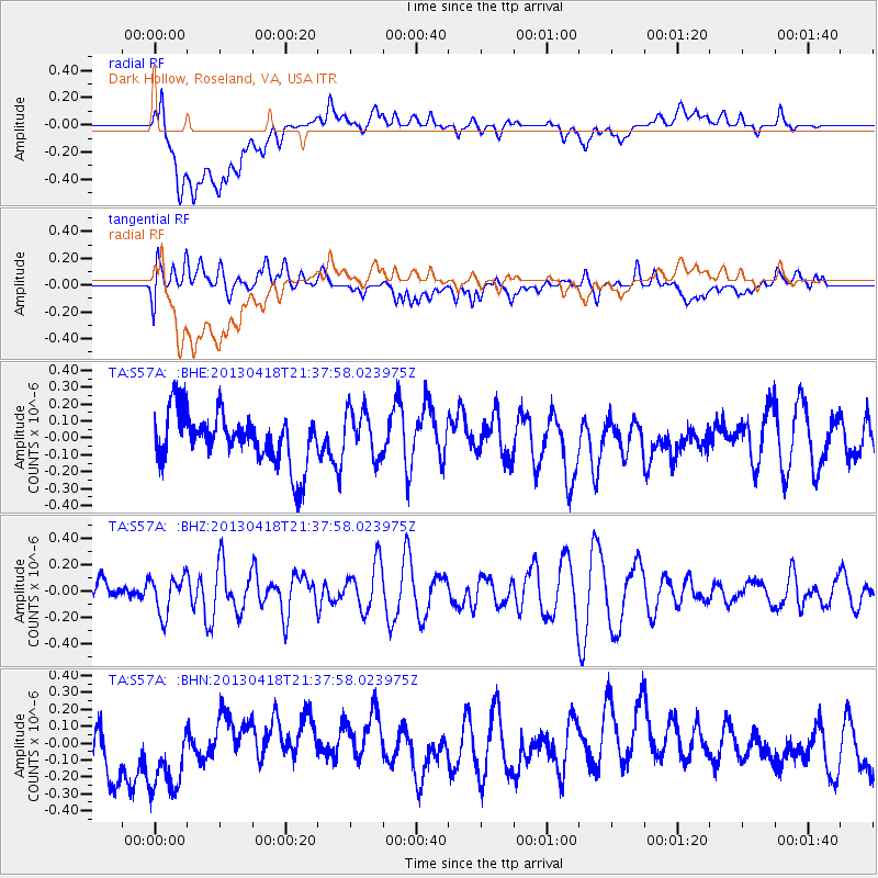
S57A Dark Hollow, Roseland, VA, USA - Earthquake Result Viewer
*The percent match for this event was below the threshold and hence no stack was calculated.
| Earthquake location: |
Southern East Pacific Rise |
| Earthquake latitude/longitude: |
-34.3/-109.2 |
| Earthquake time(UTC): |
2013/04/18 (108) 21:26:36 GMT |
| Earthquake Depth: |
10 km |
| Earthquake Magnitude: |
5.5 MW |
| Earthquake Catalog/Contributor: |
NEIC PDE/NEIC PDE-W |
|
| Network: |
TA USArray Transportable Network (new EarthScope stations) |
| Station: |
S57A Dark Hollow, Roseland, VA, USA |
| Lat/Lon: |
37.76 N/78.95 W |
| Elevation: |
264 m |
|
| Distance: |
77.1 deg |
| Az: |
24.192 deg |
| Baz: |
205.33 deg |
| Ray Param: |
$rayparam |
*The percent match for this event was below the threshold and hence was not used in the summary stack. |
|
| Radial Match: |
41.567726 % |
| Radial Bump: |
400 |
| Transverse Match: |
24.890116 % |
| Transverse Bump: |
400 |
| SOD ConfigId: |
512894 |
| Insert Time: |
2013-09-13 10:45:56.172 +0000 |
| GWidth: |
2.5 |
| Max Bumps: |
400 |
| Tol: |
0.001 |
|
Signal To Noise
| Channel | StoN | STA | LTA |
| TA:S57A: :BHZ:20130418T21:37:58.023975Z | 1.4515961 | 1.4352584E-7 | 9.8874494E-8 |
| TA:S57A: :BHN:20130418T21:37:58.023975Z | 1.4091086 | 2.6775368E-7 | 1.9001637E-7 |
| TA:S57A: :BHE:20130418T21:37:58.023975Z | 0.941165 | 1.4327895E-7 | 1.5223576E-7 |
| Arrivals |
| Ps | |
| PpPs | |
| PsPs/PpSs | |


