You are here: Home > Network List > GS - US Geological Survey Networks Stations List
> Station KAN13 Rinehart Farm > Earthquake Result Viewer
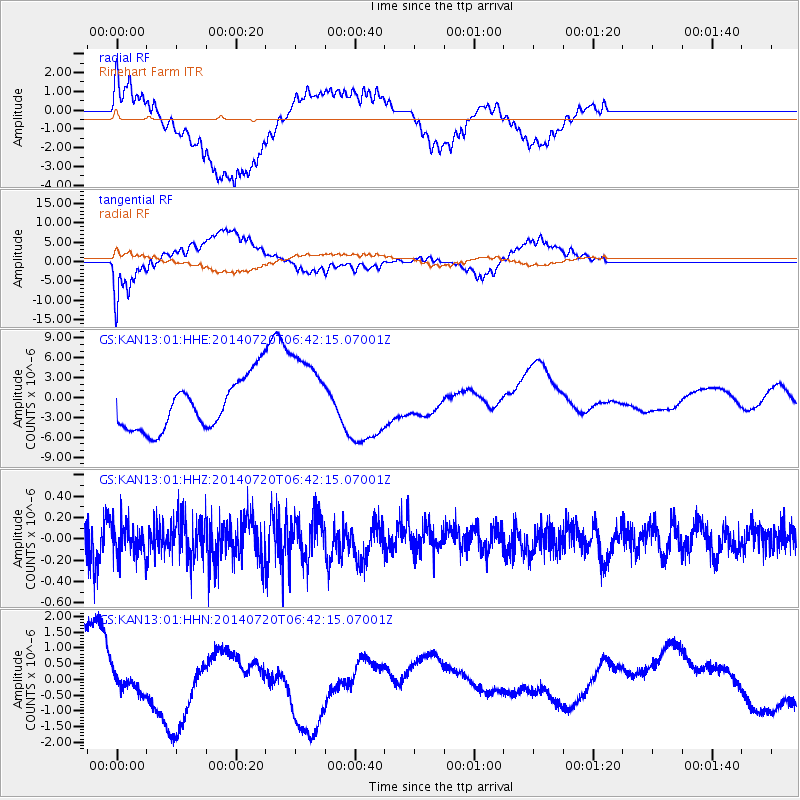
KAN13 Rinehart Farm - Earthquake Result Viewer
*The percent match for this event was below the threshold and hence no stack was calculated.
| Earthquake location: |
Central Chile |
| Earthquake latitude/longitude: |
-28.1/-70.8 |
| Earthquake time(UTC): |
2014/07/20 (201) 06:31:45 GMT |
| Earthquake Depth: |
70 km |
| Earthquake Magnitude: |
4.6 mb, 4.8 ML |
| Earthquake Catalog/Contributor: |
ISC/ISC |
|
| Network: |
GS US Geological Survey Networks |
| Station: |
KAN13 Rinehart Farm |
| Lat/Lon: |
37.01 N/97.48 W |
| Elevation: |
340 m |
|
| Distance: |
69.4 deg |
| Az: |
337.447 deg |
| Baz: |
154.951 deg |
| Ray Param: |
$rayparam |
*The percent match for this event was below the threshold and hence was not used in the summary stack. |
|
| Radial Match: |
61.377533 % |
| Radial Bump: |
400 |
| Transverse Match: |
52.961147 % |
| Transverse Bump: |
400 |
| SOD ConfigId: |
3390531 |
| Insert Time: |
2019-04-12 23:24:11.640 +0000 |
| GWidth: |
2.5 |
| Max Bumps: |
400 |
| Tol: |
0.001 |
|
Signal To Noise
| Channel | StoN | STA | LTA |
| GS:KAN13:01:HHZ:20140720T06:42:15.07001Z | 0.76493144 | 1.4570259E-7 | 1.9047796E-7 |
| GS:KAN13:01:HHN:20140720T06:42:15.07001Z | 0.38954568 | 3.9638425E-7 | 1.0175553E-6 |
| GS:KAN13:01:HHE:20140720T06:42:15.07001Z | 1.7753116 | 6.5890067E-6 | 3.711465E-6 |
| Arrivals |
| Ps | |
| PpPs | |
| PsPs/PpSs | |


