You are here: Home > Network List > LD - Lamont-Doherty Cooperative Seismographic Network Stations List
> Station MVL Millersville University, PA > Earthquake Result Viewer
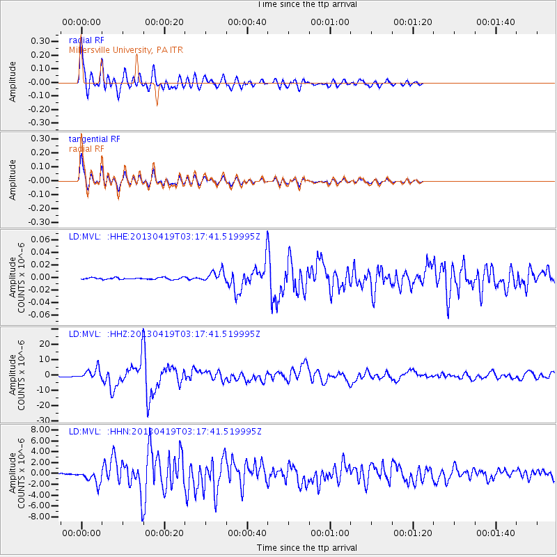
MVL Millersville University, PA - Earthquake Result Viewer
*The percent match for this event was below the threshold and hence no stack was calculated.
| Earthquake location: |
Kuril Islands |
| Earthquake latitude/longitude: |
46.2/150.8 |
| Earthquake time(UTC): |
2013/04/19 (109) 03:05:52 GMT |
| Earthquake Depth: |
110 km |
| Earthquake Magnitude: |
7.2 MW, 7.1 MB, 7.2 MW |
| Earthquake Catalog/Contributor: |
NEIC PDE/NEIC PDE-W |
|
| Network: |
LD Lamont-Doherty Cooperative Seismographic Network |
| Station: |
MVL Millersville University, PA |
| Lat/Lon: |
40.00 N/76.35 W |
| Elevation: |
91 m |
|
| Distance: |
84.4 deg |
| Az: |
34.458 deg |
| Baz: |
329.244 deg |
| Ray Param: |
$rayparam |
*The percent match for this event was below the threshold and hence was not used in the summary stack. |
|
| Radial Match: |
95.78517 % |
| Radial Bump: |
400 |
| Transverse Match: |
95.738945 % |
| Transverse Bump: |
400 |
| SOD ConfigId: |
512894 |
| Insert Time: |
2013-09-13 11:21:16.962 +0000 |
| GWidth: |
2.5 |
| Max Bumps: |
400 |
| Tol: |
0.001 |
|
Signal To Noise
| Channel | StoN | STA | LTA |
| LD:MVL: :HHZ:20130419T03:17:41.519995Z | 7.741338 | 3.3940375E-6 | 4.3843036E-7 |
| LD:MVL: :HHN:20130419T03:17:41.519995Z | 10.527458 | 1.270203E-6 | 1.206562E-7 |
| LD:MVL: :HHE:20130419T03:17:41.519995Z | 6.5234575 | 9.025194E-9 | 1.3834985E-9 |
| Arrivals |
| Ps | |
| PpPs | |
| PsPs/PpSs | |


