You are here: Home > Network List > GS - US Geological Survey Networks Stations List
> Station KAN10 Keim Farm > Earthquake Result Viewer
KAN10 Keim Farm - Earthquake Result Viewer
*The percent match for this event was below the threshold and hence no stack was calculated.
| Earthquake location: |
Fiji Islands Region |
| Earthquake latitude/longitude: |
-19.8/-178.4 |
| Earthquake time(UTC): |
2014/07/21 (202) 14:54:40 GMT |
| Earthquake Depth: |
616 km |
| Earthquake Magnitude: |
6.9 MWB, 6.9 MI |
| Earthquake Catalog/Contributor: |
NEIC PDE/NEIC ALERT |
|
| Network: |
GS US Geological Survey Networks |
| Station: |
KAN10 Keim Farm |
| Lat/Lon: |
37.12 N/98.10 W |
| Elevation: |
417 m |
|
| Distance: |
94.4 deg |
| Az: |
52.208 deg |
| Baz: |
248.602 deg |
| Ray Param: |
$rayparam |
*The percent match for this event was below the threshold and hence was not used in the summary stack. |
|
| Radial Match: |
48.20075 % |
| Radial Bump: |
400 |
| Transverse Match: |
42.95002 % |
| Transverse Bump: |
400 |
| SOD ConfigId: |
3390531 |
| Insert Time: |
2019-04-12 23:42:34.824 +0000 |
| GWidth: |
2.5 |
| Max Bumps: |
400 |
| Tol: |
0.001 |
|
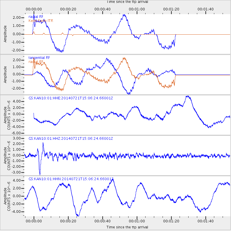
Signal To Noise
| Channel | StoN | STA | LTA |
| GS:KAN10:01:HHZ:20140721T15:06:24.66001Z | 7.7539787 | 1.2036792E-6 | 1.5523374E-7 |
| GS:KAN10:01:HHN:20140721T15:06:24.66001Z | 2.354321 | 2.3818304E-6 | 1.0116846E-6 |
| GS:KAN10:01:HHE:20140721T15:06:24.66001Z | 0.90632296 | 1.2191099E-6 | 1.3451164E-6 |
| Arrivals |
| Ps | |
| PpPs | |
| PsPs/PpSs | |


