You are here: Home > Network List > GS - US Geological Survey Networks Stations List
> Station KAN13 Rinehart Farm > Earthquake Result Viewer
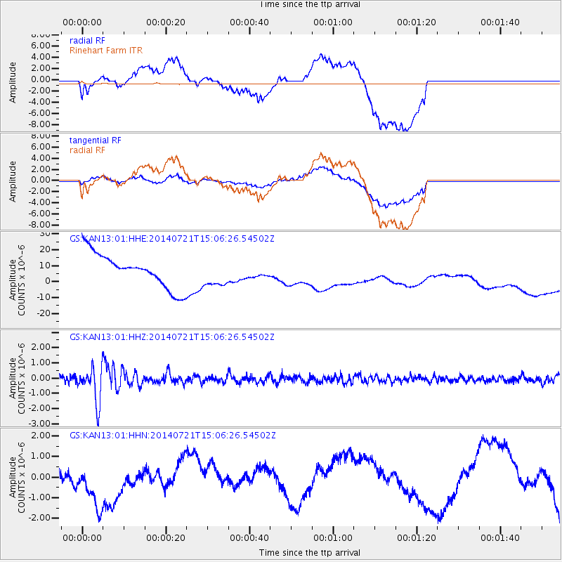
KAN13 Rinehart Farm - Earthquake Result Viewer
*The percent match for this event was below the threshold and hence no stack was calculated.
| Earthquake location: |
Fiji Islands Region |
| Earthquake latitude/longitude: |
-19.8/-178.4 |
| Earthquake time(UTC): |
2014/07/21 (202) 14:54:40 GMT |
| Earthquake Depth: |
616 km |
| Earthquake Magnitude: |
6.9 MWB, 6.9 MI |
| Earthquake Catalog/Contributor: |
NEIC PDE/NEIC ALERT |
|
| Network: |
GS US Geological Survey Networks |
| Station: |
KAN13 Rinehart Farm |
| Lat/Lon: |
37.01 N/97.48 W |
| Elevation: |
340 m |
|
| Distance: |
94.8 deg |
| Az: |
52.491 deg |
| Baz: |
248.95 deg |
| Ray Param: |
$rayparam |
*The percent match for this event was below the threshold and hence was not used in the summary stack. |
|
| Radial Match: |
25.293047 % |
| Radial Bump: |
400 |
| Transverse Match: |
17.174417 % |
| Transverse Bump: |
400 |
| SOD ConfigId: |
3390531 |
| Insert Time: |
2019-04-12 23:42:34.882 +0000 |
| GWidth: |
2.5 |
| Max Bumps: |
400 |
| Tol: |
0.001 |
|
Signal To Noise
| Channel | StoN | STA | LTA |
| GS:KAN13:01:HHZ:20140721T15:06:26.54502Z | 6.402902 | 1.1767579E-6 | 1.8378508E-7 |
| GS:KAN13:01:HHN:20140721T15:06:26.54502Z | 0.31738147 | 7.1528876E-7 | 2.2537192E-6 |
| GS:KAN13:01:HHE:20140721T15:06:26.54502Z | 0.8459503 | 8.904339E-6 | 1.0525841E-5 |
| Arrivals |
| Ps | |
| PpPs | |
| PsPs/PpSs | |


