You are here: Home > Network List > TA - USArray Transportable Network (new EarthScope stations) Stations List
> Station G45A Suttons Bay, MI, USA > Earthquake Result Viewer
G45A Suttons Bay, MI, USA - Earthquake Result Viewer
| Earthquake location: |
Kuril Islands |
| Earthquake latitude/longitude: |
46.2/150.8 |
| Earthquake time(UTC): |
2013/04/19 (109) 03:05:52 GMT |
| Earthquake Depth: |
110 km |
| Earthquake Magnitude: |
7.2 MW, 7.1 MB, 7.2 MW |
| Earthquake Catalog/Contributor: |
NEIC PDE/NEIC PDE-W |
|
| Network: |
TA USArray Transportable Network (new EarthScope stations) |
| Station: |
G45A Suttons Bay, MI, USA |
| Lat/Lon: |
45.04 N/85.66 W |
| Elevation: |
284 m |
|
| Distance: |
76.4 deg |
| Az: |
37.44 deg |
| Baz: |
323.463 deg |
| Ray Param: |
0.05077389 |
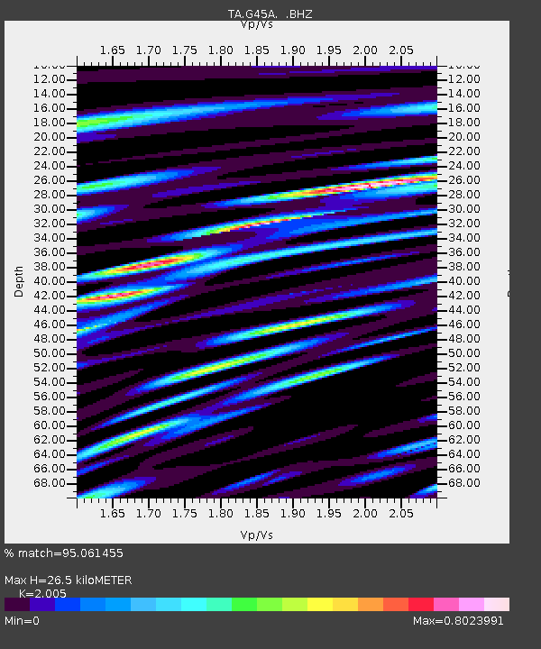
| Estimated Moho Depth: |
26.5 km |
| Estimated Crust Vp/Vs: |
2.01 |
| Assumed Crust Vp: |
6.483 km/s |
| Estimated Crust Vs: |
3.233 km/s |
| Estimated Crust Poisson's Ratio: |
0.33 |
|
| Radial Match: |
95.061455 % |
| Radial Bump: |
400 |
| Transverse Match: |
85.238594 % |
| Transverse Bump: |
400 |
| SOD ConfigId: |
512894 |
| Insert Time: |
2013-09-13 11:38:14.311 +0000 |
| GWidth: |
2.5 |
| Max Bumps: |
400 |
| Tol: |
0.001 |
|
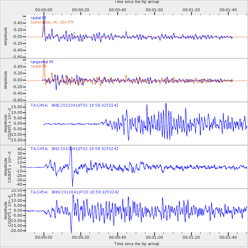
Signal To Noise
| Channel | StoN | STA | LTA |
| TA:G45A: :BHZ:20130419T03:16:58.925024Z | 28.217684 | 6.151679E-6 | 2.1800793E-7 |
| TA:G45A: :BHN:20130419T03:16:58.925024Z | 8.743404 | 2.4214476E-6 | 2.7694563E-7 |
| TA:G45A: :BHE:20130419T03:16:58.925024Z | 5.0563707 | 1.4803574E-6 | 2.9277072E-7 |
| Arrivals |
| Ps | 4.2 SECOND |
| PpPs | 12 SECOND |
| PsPs/PpSs | 16 SECOND |


