You are here: Home > Network List > TA - USArray Transportable Network (new EarthScope stations) Stations List
> Station J46A Howard City, MI, USA > Earthquake Result Viewer
J46A Howard City, MI, USA - Earthquake Result Viewer

| Earthquake location: |
Kuril Islands |
| Earthquake latitude/longitude: |
46.2/150.8 |
| Earthquake time(UTC): |
2013/04/19 (109) 03:05:52 GMT |
| Earthquake Depth: |
110 km |
| Earthquake Magnitude: |
7.2 MW, 7.1 MB, 7.2 MW |
| Earthquake Catalog/Contributor: |
NEIC PDE/NEIC PDE-W |
|
| Network: |
TA USArray Transportable Network (new EarthScope stations) |
| Station: |
J46A Howard City, MI, USA |
| Lat/Lon: |
43.35 N/85.65 W |
| Elevation: |
275 m |
|
| Distance: |
77.7 deg |
| Az: |
38.464 deg |
| Baz: |
323.7 deg |
| Ray Param: |
0.049855337 |
| Estimated Moho Depth: |
11.25 km |
| Estimated Crust Vp/Vs: |
2.10 |
| Assumed Crust Vp: |
6.483 km/s |
| Estimated Crust Vs: |
3.094 km/s |
| Estimated Crust Poisson's Ratio: |
0.35 |
|
| Radial Match: |
96.03043 % |
| Radial Bump: |
400 |
| Transverse Match: |
90.08458 % |
| Transverse Bump: |
400 |
| SOD ConfigId: |
512894 |
| Insert Time: |
2013-09-13 11:40:44.934 +0000 |
| GWidth: |
2.5 |
| Max Bumps: |
400 |
| Tol: |
0.001 |
|
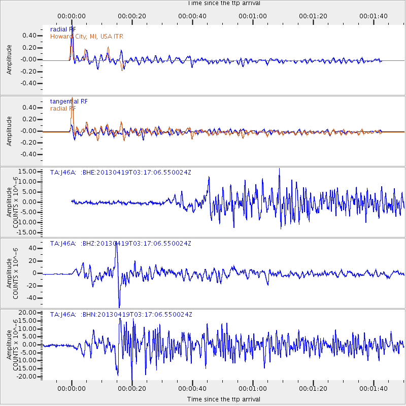
Signal To Noise
| Channel | StoN | STA | LTA |
| TA:J46A: :BHZ:20130419T03:17:06.550024Z | 18.641077 | 6.5604568E-6 | 3.5193548E-7 |
| TA:J46A: :BHN:20130419T03:17:06.550024Z | 8.248909 | 2.5581423E-6 | 3.1011888E-7 |
| TA:J46A: :BHE:20130419T03:17:06.550024Z | 3.3596585 | 1.362231E-6 | 4.0546712E-7 |
| Arrivals |
| Ps | 1.9 SECOND |
| PpPs | 5.2 SECOND |
| PsPs/PpSs | 7.2 SECOND |


