You are here: Home > Network List > TA - USArray Transportable Network (new EarthScope stations) Stations List
> Station S22A 4UR Ranch, Creede, CO, USA > Earthquake Result Viewer
S22A 4UR Ranch, Creede, CO, USA - Earthquake Result Viewer

| Earthquake location: |
Kuril Islands |
| Earthquake latitude/longitude: |
46.2/150.8 |
| Earthquake time(UTC): |
2013/04/19 (109) 03:05:52 GMT |
| Earthquake Depth: |
110 km |
| Earthquake Magnitude: |
7.2 MW, 7.1 MB, 7.2 MW |
| Earthquake Catalog/Contributor: |
NEIC PDE/NEIC PDE-W |
|
| Network: |
TA USArray Transportable Network (new EarthScope stations) |
| Station: |
S22A 4UR Ranch, Creede, CO, USA |
| Lat/Lon: |
37.75 N/106.83 W |
| Elevation: |
2626 m |
|
| Distance: |
71.3 deg |
| Az: |
54.83 deg |
| Baz: |
314.278 deg |
| Ray Param: |
0.05414569 |
| Estimated Moho Depth: |
40.0 km |
| Estimated Crust Vp/Vs: |
2.08 |
| Assumed Crust Vp: |
6.159 km/s |
| Estimated Crust Vs: |
2.964 km/s |
| Estimated Crust Poisson's Ratio: |
0.35 |
|
| Radial Match: |
95.236244 % |
| Radial Bump: |
400 |
| Transverse Match: |
93.08582 % |
| Transverse Bump: |
400 |
| SOD ConfigId: |
512894 |
| Insert Time: |
2013-09-13 11:47:48.076 +0000 |
| GWidth: |
2.5 |
| Max Bumps: |
400 |
| Tol: |
0.001 |
|
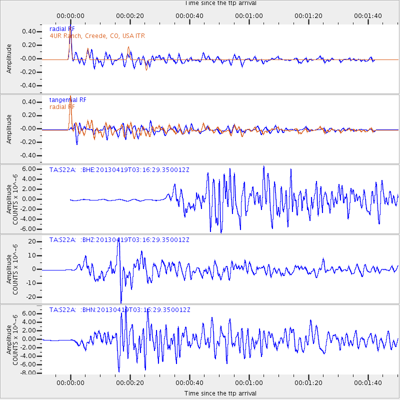
Signal To Noise
| Channel | StoN | STA | LTA |
| TA:S22A: :BHZ:20130419T03:16:29.350012Z | 28.913116 | 2.780248E-6 | 9.615871E-8 |
| TA:S22A: :BHN:20130419T03:16:29.350012Z | 7.5391855 | 7.2967606E-7 | 9.678446E-8 |
| TA:S22A: :BHE:20130419T03:16:29.350012Z | 8.329205 | 8.3232663E-7 | 9.9928705E-8 |
| Arrivals |
| Ps | 7.2 SECOND |
| PpPs | 19 SECOND |
| PsPs/PpSs | 27 SECOND |


