You are here: Home > Network List > TA - USArray Transportable Network (new EarthScope stations) Stations List
> Station D62A Allapoint, Allagash, ME, USA > Earthquake Result Viewer
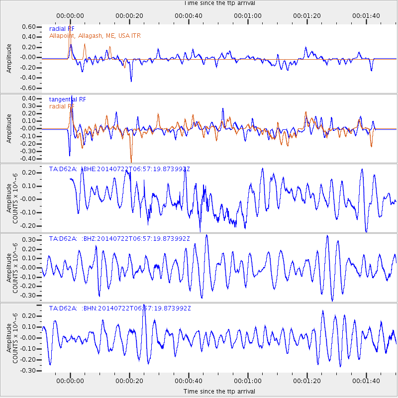
D62A Allapoint, Allagash, ME, USA - Earthquake Result Viewer
*The percent match for this event was below the threshold and hence no stack was calculated.
| Earthquake location: |
Gulf Of California |
| Earthquake latitude/longitude: |
25.9/-110.5 |
| Earthquake time(UTC): |
2014/07/22 (203) 06:50:25 GMT |
| Earthquake Depth: |
10 km |
| Earthquake Magnitude: |
5.1 MW, 4.6 Md, 4.8 Mwr, 4.9 mb |
| Earthquake Catalog/Contributor: |
ISC/ISC |
|
| Network: |
TA USArray Transportable Network (new EarthScope stations) |
| Station: |
D62A Allapoint, Allagash, ME, USA |
| Lat/Lon: |
47.08 N/69.05 W |
| Elevation: |
189 m |
|
| Distance: |
38.9 deg |
| Az: |
46.103 deg |
| Baz: |
251.76 deg |
| Ray Param: |
$rayparam |
*The percent match for this event was below the threshold and hence was not used in the summary stack. |
|
| Radial Match: |
49.437843 % |
| Radial Bump: |
400 |
| Transverse Match: |
52.277008 % |
| Transverse Bump: |
400 |
| SOD ConfigId: |
3390531 |
| Insert Time: |
2019-04-12 23:53:07.232 +0000 |
| GWidth: |
2.5 |
| Max Bumps: |
400 |
| Tol: |
0.001 |
|
Signal To Noise
| Channel | StoN | STA | LTA |
| TA:D62A: :BHZ:20140722T06:57:19.873992Z | 1.403067 | 9.405721E-8 | 6.7036865E-8 |
| TA:D62A: :BHN:20140722T06:57:19.873992Z | 0.17593144 | 2.0550777E-8 | 1.16811286E-7 |
| TA:D62A: :BHE:20140722T06:57:19.873992Z | 1.1344259 | 9.50297E-8 | 8.376898E-8 |
| Arrivals |
| Ps | |
| PpPs | |
| PsPs/PpSs | |


