You are here: Home > Network List > TA - USArray Transportable Network (new EarthScope stations) Stations List
> Station T60A Surry, VA, USA > Earthquake Result Viewer
T60A Surry, VA, USA - Earthquake Result Viewer

| Earthquake location: |
Kuril Islands |
| Earthquake latitude/longitude: |
46.2/150.8 |
| Earthquake time(UTC): |
2013/04/19 (109) 03:05:52 GMT |
| Earthquake Depth: |
110 km |
| Earthquake Magnitude: |
7.2 MW, 7.1 MB, 7.2 MW |
| Earthquake Catalog/Contributor: |
NEIC PDE/NEIC PDE-W |
|
| Network: |
TA USArray Transportable Network (new EarthScope stations) |
| Station: |
T60A Surry, VA, USA |
| Lat/Lon: |
37.14 N/76.73 W |
| Elevation: |
11 m |
|
| Distance: |
86.7 deg |
| Az: |
36.184 deg |
| Baz: |
329.14 deg |
| Ray Param: |
0.04364251 |
| Estimated Moho Depth: |
23.0 km |
| Estimated Crust Vp/Vs: |
1.93 |
| Assumed Crust Vp: |
6.565 km/s |
| Estimated Crust Vs: |
3.393 km/s |
| Estimated Crust Poisson's Ratio: |
0.32 |
|
| Radial Match: |
93.98369 % |
| Radial Bump: |
400 |
| Transverse Match: |
93.71084 % |
| Transverse Bump: |
361 |
| SOD ConfigId: |
512894 |
| Insert Time: |
2013-09-13 11:49:31.390 +0000 |
| GWidth: |
2.5 |
| Max Bumps: |
400 |
| Tol: |
0.001 |
|
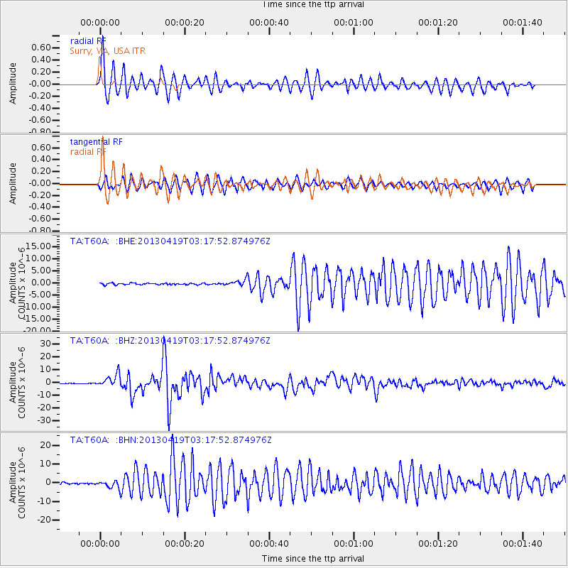
Signal To Noise
| Channel | StoN | STA | LTA |
| TA:T60A: :BHZ:20130419T03:17:52.874976Z | 25.928827 | 5.1579545E-6 | 1.9892741E-7 |
| TA:T60A: :BHN:20130419T03:17:52.874976Z | 6.2550426 | 2.0827708E-6 | 3.3297465E-7 |
| TA:T60A: :BHE:20130419T03:17:52.874976Z | 4.0996046 | 1.3009306E-6 | 3.1733074E-7 |
| Arrivals |
| Ps | 3.3 SECOND |
| PpPs | 10 SECOND |
| PsPs/PpSs | 13 SECOND |


