You are here: Home > Network List > US - United States National Seismic Network Stations List
> Station AMTX Amarillo, Texas, USA > Earthquake Result Viewer
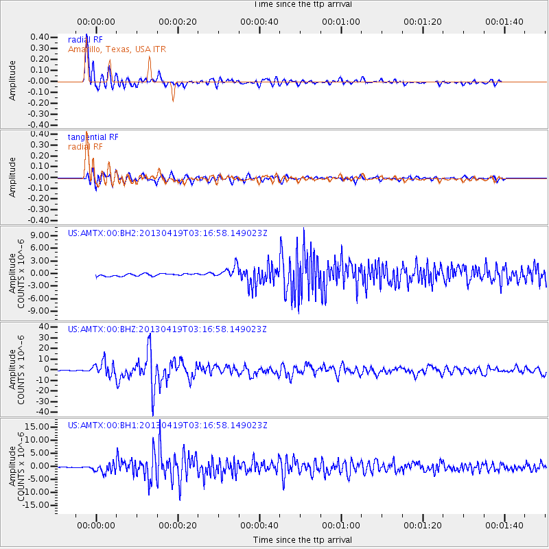
AMTX Amarillo, Texas, USA - Earthquake Result Viewer
*The percent match for this event was below the threshold and hence no stack was calculated.
| Earthquake location: |
Kuril Islands |
| Earthquake latitude/longitude: |
46.2/150.8 |
| Earthquake time(UTC): |
2013/04/19 (109) 03:05:52 GMT |
| Earthquake Depth: |
110 km |
| Earthquake Magnitude: |
7.2 MW, 7.1 MB, 7.2 MW |
| Earthquake Catalog/Contributor: |
NEIC PDE/NEIC PDE-W |
|
| Network: |
US United States National Seismic Network |
| Station: |
AMTX Amarillo, Texas, USA |
| Lat/Lon: |
34.53 N/101.41 W |
| Elevation: |
1010 m |
|
| Distance: |
76.7 deg |
| Az: |
53.889 deg |
| Baz: |
317.204 deg |
| Ray Param: |
$rayparam |
*The percent match for this event was below the threshold and hence was not used in the summary stack. |
|
| Radial Match: |
95.98681 % |
| Radial Bump: |
400 |
| Transverse Match: |
91.24238 % |
| Transverse Bump: |
400 |
| SOD ConfigId: |
512894 |
| Insert Time: |
2013-09-13 11:55:33.572 +0000 |
| GWidth: |
2.5 |
| Max Bumps: |
400 |
| Tol: |
0.001 |
|
Signal To Noise
| Channel | StoN | STA | LTA |
| US:AMTX:00:BHZ:20130419T03:16:58.149023Z | 25.22603 | 6.6499306E-6 | 2.6361383E-7 |
| US:AMTX:00:BH1:20130419T03:16:58.149023Z | 11.465852 | 1.8130579E-6 | 1.5812675E-7 |
| US:AMTX:00:BH2:20130419T03:16:58.149023Z | 5.7266297 | 1.5534612E-6 | 2.712697E-7 |
| Arrivals |
| Ps | |
| PpPs | |
| PsPs/PpSs | |


