You are here: Home > Network List > US - United States National Seismic Network Stations List
> Station DGMT Dagmar, Montana, USA > Earthquake Result Viewer
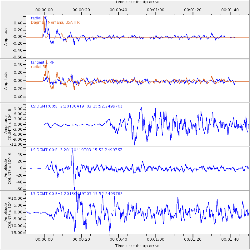
DGMT Dagmar, Montana, USA - Earthquake Result Viewer
*The percent match for this event was below the threshold and hence no stack was calculated.
| Earthquake location: |
Kuril Islands |
| Earthquake latitude/longitude: |
46.2/150.8 |
| Earthquake time(UTC): |
2013/04/19 (109) 03:05:52 GMT |
| Earthquake Depth: |
110 km |
| Earthquake Magnitude: |
7.2 MW, 7.1 MB, 7.2 MW |
| Earthquake Catalog/Contributor: |
NEIC PDE/NEIC PDE-W |
|
| Network: |
US United States National Seismic Network |
| Station: |
DGMT Dagmar, Montana, USA |
| Lat/Lon: |
48.47 N/104.20 W |
| Elevation: |
0.0 m |
|
| Distance: |
65.3 deg |
| Az: |
45.02 deg |
| Baz: |
312.442 deg |
| Ray Param: |
$rayparam |
*The percent match for this event was below the threshold and hence was not used in the summary stack. |
|
| Radial Match: |
93.59797 % |
| Radial Bump: |
400 |
| Transverse Match: |
86.66791 % |
| Transverse Bump: |
400 |
| SOD ConfigId: |
512894 |
| Insert Time: |
2013-09-13 11:56:06.141 +0000 |
| GWidth: |
2.5 |
| Max Bumps: |
400 |
| Tol: |
0.001 |
|
Signal To Noise
| Channel | StoN | STA | LTA |
| US:DGMT:00:BHZ:20130419T03:15:52.249976Z | 41.477154 | 7.303002E-6 | 1.7607287E-7 |
| US:DGMT:00:BH1:20130419T03:15:52.249976Z | 3.3422227 | 1.7550904E-6 | 5.2512667E-7 |
| US:DGMT:00:BH2:20130419T03:15:52.249976Z | 2.7791836 | 1.4729358E-6 | 5.2998865E-7 |
| Arrivals |
| Ps | |
| PpPs | |
| PsPs/PpSs | |


