You are here: Home > Network List > WY - Yellowstone Wyoming Seismic Network Stations List
> Station YPP Pitchstone Plateau, YNP, WY, USA > Earthquake Result Viewer
YPP Pitchstone Plateau, YNP, WY, USA - Earthquake Result Viewer
*The percent match for this event was below the threshold and hence no stack was calculated.
| Earthquake location: |
Kuril Islands |
| Earthquake latitude/longitude: |
46.2/150.8 |
| Earthquake time(UTC): |
2013/04/19 (109) 03:05:52 GMT |
| Earthquake Depth: |
110 km |
| Earthquake Magnitude: |
7.2 MW, 7.1 MB, 7.2 MW |
| Earthquake Catalog/Contributor: |
NEIC PDE/NEIC PDE-W |
|
| Network: |
WY Yellowstone Wyoming Seismic Network |
| Station: |
YPP Pitchstone Plateau, YNP, WY, USA |
| Lat/Lon: |
44.27 N/110.80 W |
| Elevation: |
2707 m |
|
| Distance: |
64.7 deg |
| Az: |
51.833 deg |
| Baz: |
310.549 deg |
| Ray Param: |
$rayparam |
*The percent match for this event was below the threshold and hence was not used in the summary stack. |
|
| Radial Match: |
89.739204 % |
| Radial Bump: |
400 |
| Transverse Match: |
81.49142 % |
| Transverse Bump: |
400 |
| SOD ConfigId: |
512894 |
| Insert Time: |
2013-09-13 12:03:22.355 +0000 |
| GWidth: |
2.5 |
| Max Bumps: |
400 |
| Tol: |
0.001 |
|
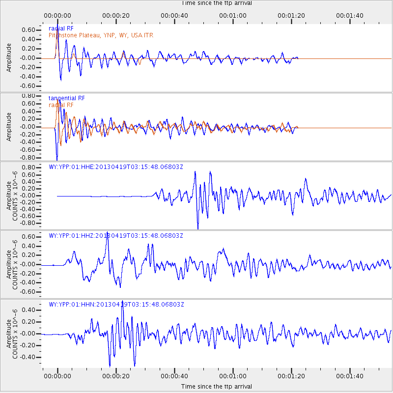
Signal To Noise
| Channel | StoN | STA | LTA |
| WY:YPP:01:HHZ:20130419T03:15:48.06803Z | 13.439793 | 5.5453103E-8 | 4.1260386E-9 |
| WY:YPP:01:HHN:20130419T03:15:48.06803Z | 5.1718884 | 1.7900625E-8 | 3.4611392E-9 |
| WY:YPP:01:HHE:20130419T03:15:48.06803Z | 15.307552 | 4.0128928E-8 | 2.6215117E-9 |
| Arrivals |
| Ps | |
| PpPs | |
| PsPs/PpSs | |


