You are here: Home > Network List > IU - Global Seismograph Network (GSN - IRIS/USGS) Stations List
> Station MAJO Matsushiro, Japan > Earthquake Result Viewer
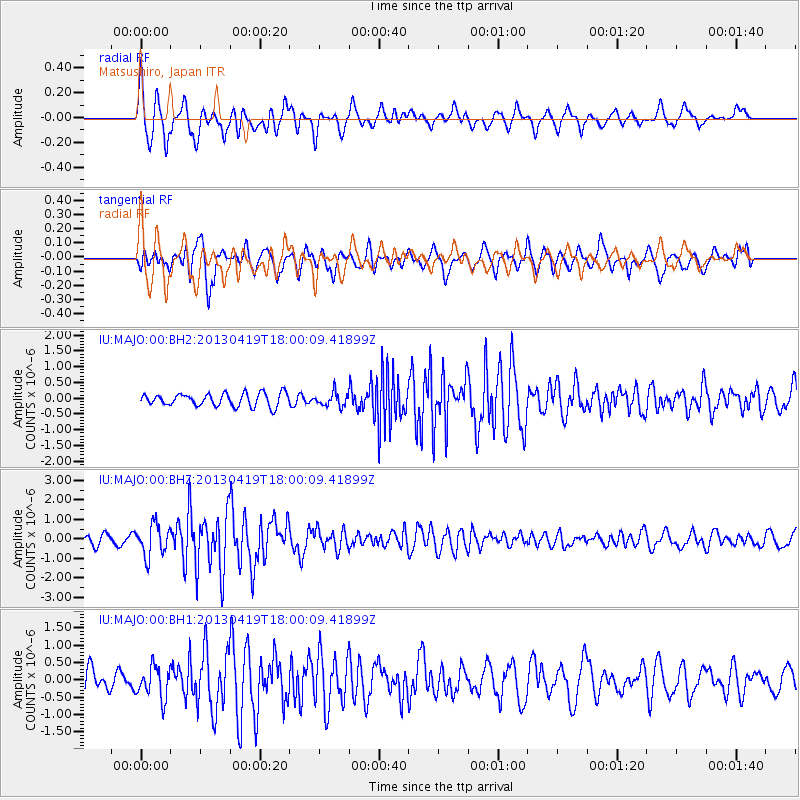
MAJO Matsushiro, Japan - Earthquake Result Viewer
*The percent match for this event was below the threshold and hence no stack was calculated.
| Earthquake location: |
South Of Timor, Indonesia |
| Earthquake latitude/longitude: |
-12.0/121.6 |
| Earthquake time(UTC): |
2013/04/19 (109) 17:51:41 GMT |
| Earthquake Depth: |
15 km |
| Earthquake Magnitude: |
5.8 MW, 5.7 MW, 6.0 MB |
| Earthquake Catalog/Contributor: |
NEIC PDE/NEIC PDE-W |
|
| Network: |
IU Global Seismograph Network (GSN - IRIS/USGS) |
| Station: |
MAJO Matsushiro, Japan |
| Lat/Lon: |
36.55 N/138.20 E |
| Elevation: |
405 m |
|
| Distance: |
50.7 deg |
| Az: |
17.259 deg |
| Baz: |
201.132 deg |
| Ray Param: |
$rayparam |
*The percent match for this event was below the threshold and hence was not used in the summary stack. |
|
| Radial Match: |
75.23349 % |
| Radial Bump: |
400 |
| Transverse Match: |
78.37003 % |
| Transverse Bump: |
400 |
| SOD ConfigId: |
512894 |
| Insert Time: |
2013-09-13 12:09:36.949 +0000 |
| GWidth: |
2.5 |
| Max Bumps: |
400 |
| Tol: |
0.001 |
|
Signal To Noise
| Channel | StoN | STA | LTA |
| IU:MAJO:00:BHZ:20130419T18:00:09.41899Z | 4.524948 | 7.9904135E-7 | 1.7658576E-7 |
| IU:MAJO:00:BH1:20130419T18:00:09.41899Z | 1.7966607 | 4.4947097E-7 | 2.5017022E-7 |
| IU:MAJO:00:BH2:20130419T18:00:09.41899Z | 1.0621036 | 2.1525916E-7 | 2.0267245E-7 |
| Arrivals |
| Ps | |
| PpPs | |
| PsPs/PpSs | |


