You are here: Home > Network List > AG - Arkansas Seismic Network Stations List
> Station LCAR Lake Charles,AR > Earthquake Result Viewer
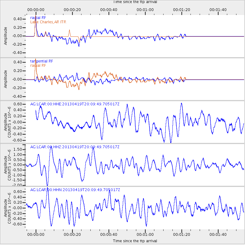
LCAR Lake Charles,AR - Earthquake Result Viewer
*The percent match for this event was below the threshold and hence no stack was calculated.
| Earthquake location: |
East Of Kuril Islands |
| Earthquake latitude/longitude: |
50.0/157.7 |
| Earthquake time(UTC): |
2013/04/19 (109) 19:58:40 GMT |
| Earthquake Depth: |
15 km |
| Earthquake Magnitude: |
6.1 MW, 5.9 MB, 6.0 MW, 6.1 MS |
| Earthquake Catalog/Contributor: |
NEIC PDE/NEIC PDE-W |
|
| Network: |
AG Arkansas Seismic Network |
| Station: |
LCAR Lake Charles,AR |
| Lat/Lon: |
36.07 N/91.15 W |
| Elevation: |
103 m |
|
| Distance: |
75.0 deg |
| Az: |
51.438 deg |
| Baz: |
321.444 deg |
| Ray Param: |
$rayparam |
*The percent match for this event was below the threshold and hence was not used in the summary stack. |
|
| Radial Match: |
69.040825 % |
| Radial Bump: |
400 |
| Transverse Match: |
60.379303 % |
| Transverse Bump: |
400 |
| SOD ConfigId: |
512894 |
| Insert Time: |
2013-09-13 12:13:29.332 +0000 |
| GWidth: |
2.5 |
| Max Bumps: |
400 |
| Tol: |
0.001 |
|
Signal To Noise
| Channel | StoN | STA | LTA |
| AG:LCAR:00:HHZ:20130419T20:09:49.705017Z | 6.2595124 | 5.8447904E-7 | 9.337453E-8 |
| AG:LCAR:00:HHN:20130419T20:09:49.705017Z | 1.4791769 | 2.194949E-7 | 1.4838989E-7 |
| AG:LCAR:00:HHE:20130419T20:09:49.705017Z | 0.73731357 | 1.5596154E-7 | 2.1152675E-7 |
| Arrivals |
| Ps | |
| PpPs | |
| PsPs/PpSs | |


