You are here: Home > Network List > CN - Canadian National Seismograph Network Stations List
> Station WHY Whitehorse, YT > Earthquake Result Viewer
WHY Whitehorse, YT - Earthquake Result Viewer

| Earthquake location: |
East Of Kuril Islands |
| Earthquake latitude/longitude: |
50.0/157.7 |
| Earthquake time(UTC): |
2013/04/19 (109) 19:58:40 GMT |
| Earthquake Depth: |
15 km |
| Earthquake Magnitude: |
6.1 MW, 5.9 MB, 6.0 MW, 6.1 MS |
| Earthquake Catalog/Contributor: |
NEIC PDE/NEIC PDE-W |
|
| Network: |
CN Canadian National Seismograph Network |
| Station: |
WHY Whitehorse, YT |
| Lat/Lon: |
60.66 N/134.88 W |
| Elevation: |
1292 m |
|
| Distance: |
38.2 deg |
| Az: |
47.425 deg |
| Baz: |
285.074 deg |
| Ray Param: |
0.07571455 |
| Estimated Moho Depth: |
43.5 km |
| Estimated Crust Vp/Vs: |
1.60 |
| Assumed Crust Vp: |
6.419 km/s |
| Estimated Crust Vs: |
4.012 km/s |
| Estimated Crust Poisson's Ratio: |
0.18 |
|
| Radial Match: |
95.05347 % |
| Radial Bump: |
289 |
| Transverse Match: |
83.13955 % |
| Transverse Bump: |
400 |
| SOD ConfigId: |
512894 |
| Insert Time: |
2013-09-13 12:23:35.078 +0000 |
| GWidth: |
2.5 |
| Max Bumps: |
400 |
| Tol: |
0.001 |
|
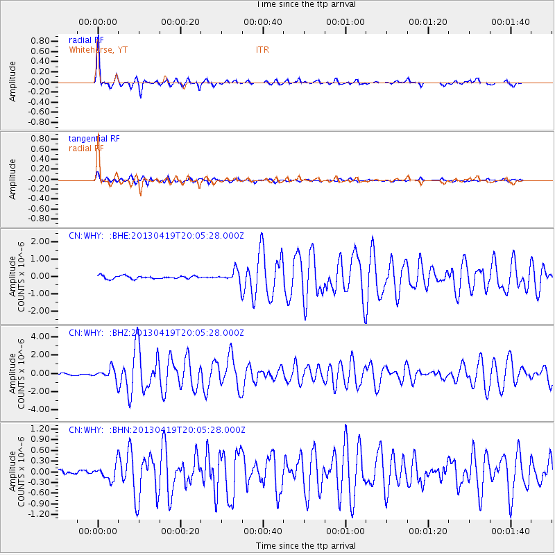
Signal To Noise
| Channel | StoN | STA | LTA |
| CN:WHY: :BHZ:20130419T20:05:28.000Z | 6.5479083 | 6.5027416E-7 | 9.931021E-8 |
| CN:WHY: :BHN:20130419T20:05:28.000Z | 4.0656047 | 2.1815362E-7 | 5.3658344E-8 |
| CN:WHY: :BHE:20130419T20:05:28.000Z | 4.546143 | 3.845617E-7 | 8.4590766E-8 |
| Arrivals |
| Ps | 4.4 SECOND |
| PpPs | 16 SECOND |
| PsPs/PpSs | 21 SECOND |


