You are here: Home > Network List > TA - USArray Transportable Network (new EarthScope stations) Stations List
> Station K48A Perry, MI, USA > Earthquake Result Viewer
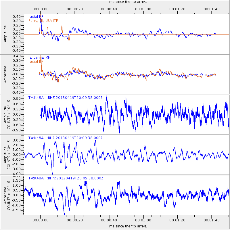
K48A Perry, MI, USA - Earthquake Result Viewer
*The percent match for this event was below the threshold and hence no stack was calculated.
| Earthquake location: |
East Of Kuril Islands |
| Earthquake latitude/longitude: |
50.0/157.7 |
| Earthquake time(UTC): |
2013/04/19 (109) 19:58:40 GMT |
| Earthquake Depth: |
15 km |
| Earthquake Magnitude: |
6.1 MW, 5.9 MB, 6.0 MW, 6.1 MS |
| Earthquake Catalog/Contributor: |
NEIC PDE/NEIC PDE-W |
|
| Network: |
TA USArray Transportable Network (new EarthScope stations) |
| Station: |
K48A Perry, MI, USA |
| Lat/Lon: |
42.80 N/84.12 W |
| Elevation: |
273 m |
|
| Distance: |
73.0 deg |
| Az: |
42.688 deg |
| Baz: |
323.492 deg |
| Ray Param: |
$rayparam |
*The percent match for this event was below the threshold and hence was not used in the summary stack. |
|
| Radial Match: |
68.32091 % |
| Radial Bump: |
400 |
| Transverse Match: |
59.380062 % |
| Transverse Bump: |
400 |
| SOD ConfigId: |
512894 |
| Insert Time: |
2013-09-13 12:52:40.451 +0000 |
| GWidth: |
2.5 |
| Max Bumps: |
400 |
| Tol: |
0.001 |
|
Signal To Noise
| Channel | StoN | STA | LTA |
| TA:K48A: :BHZ:20130419T20:09:38.000Z | 4.790437 | 1.1928306E-6 | 2.4900245E-7 |
| TA:K48A: :BHN:20130419T20:09:38.000Z | 1.3993644 | 4.7986396E-7 | 3.4291565E-7 |
| TA:K48A: :BHE:20130419T20:09:38.000Z | 1.0867007 | 2.5701922E-7 | 2.3651336E-7 |
| Arrivals |
| Ps | |
| PpPs | |
| PsPs/PpSs | |


