You are here: Home > Network List > TA - USArray Transportable Network (new EarthScope stations) Stations List
> Station P47A Martinsville, IN, USA > Earthquake Result Viewer
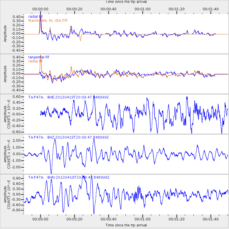
P47A Martinsville, IN, USA - Earthquake Result Viewer
*The percent match for this event was below the threshold and hence no stack was calculated.
| Earthquake location: |
East Of Kuril Islands |
| Earthquake latitude/longitude: |
50.0/157.7 |
| Earthquake time(UTC): |
2013/04/19 (109) 19:58:40 GMT |
| Earthquake Depth: |
15 km |
| Earthquake Magnitude: |
6.1 MW, 5.9 MB, 6.0 MW, 6.1 MS |
| Earthquake Catalog/Contributor: |
NEIC PDE/NEIC PDE-W |
|
| Network: |
TA USArray Transportable Network (new EarthScope stations) |
| Station: |
P47A Martinsville, IN, USA |
| Lat/Lon: |
39.49 N/86.27 W |
| Elevation: |
246 m |
|
| Distance: |
74.7 deg |
| Az: |
46.105 deg |
| Baz: |
323.033 deg |
| Ray Param: |
$rayparam |
*The percent match for this event was below the threshold and hence was not used in the summary stack. |
|
| Radial Match: |
68.95262 % |
| Radial Bump: |
400 |
| Transverse Match: |
51.032146 % |
| Transverse Bump: |
400 |
| SOD ConfigId: |
512894 |
| Insert Time: |
2013-09-13 12:57:26.360 +0000 |
| GWidth: |
2.5 |
| Max Bumps: |
400 |
| Tol: |
0.001 |
|
Signal To Noise
| Channel | StoN | STA | LTA |
| TA:P47A: :BHZ:20130419T20:09:47.848999Z | 3.3673966 | 6.02763E-7 | 1.789997E-7 |
| TA:P47A: :BHN:20130419T20:09:47.848999Z | 1.3828244 | 3.900853E-7 | 2.8209314E-7 |
| TA:P47A: :BHE:20130419T20:09:47.848999Z | 2.2984235 | 2.970597E-7 | 1.2924498E-7 |
| Arrivals |
| Ps | |
| PpPs | |
| PsPs/PpSs | |


