You are here: Home > Network List > AV - Alaska Volcano Observatory Stations List
> Station MAPS Pakushin Southeast, Makushin Volcano, Alaska > Earthquake Result Viewer
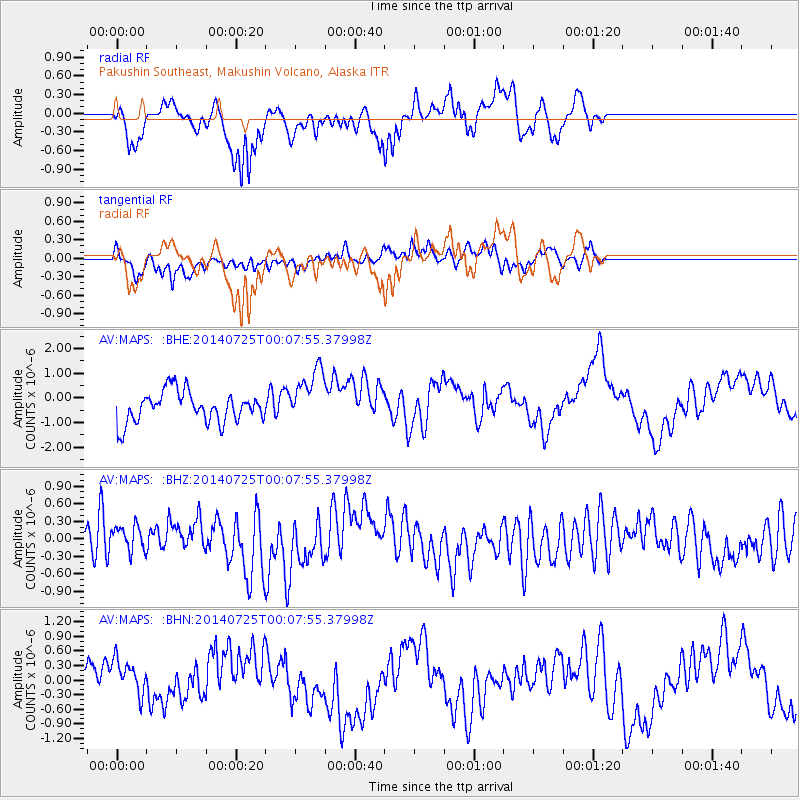
MAPS Pakushin Southeast, Makushin Volcano, Alaska - Earthquake Result Viewer
*The percent match for this event was below the threshold and hence no stack was calculated.
| Earthquake location: |
Leyte, Philippines |
| Earthquake latitude/longitude: |
10.4/125.2 |
| Earthquake time(UTC): |
2014/07/24 (205) 23:57:26 GMT |
| Earthquake Depth: |
32 km |
| Earthquake Magnitude: |
5.4 MW, 4.9 MS, 5.3 mb |
| Earthquake Catalog/Contributor: |
ISC/ISC |
|
| Network: |
AV Alaska Volcano Observatory |
| Station: |
MAPS Pakushin Southeast, Makushin Volcano, Alaska |
| Lat/Lon: |
53.81 N/166.94 W |
| Elevation: |
333 m |
|
| Distance: |
68.6 deg |
| Az: |
36.155 deg |
| Baz: |
258.113 deg |
| Ray Param: |
$rayparam |
*The percent match for this event was below the threshold and hence was not used in the summary stack. |
|
| Radial Match: |
62.276535 % |
| Radial Bump: |
400 |
| Transverse Match: |
46.757565 % |
| Transverse Bump: |
400 |
| SOD ConfigId: |
3390531 |
| Insert Time: |
2019-04-13 00:28:31.813 +0000 |
| GWidth: |
2.5 |
| Max Bumps: |
400 |
| Tol: |
0.001 |
|
Signal To Noise
| Channel | StoN | STA | LTA |
| AV:MAPS: :BHZ:20140725T00:07:55.37998Z | 0.73505896 | 2.3000075E-7 | 3.1290108E-7 |
| AV:MAPS: :BHN:20140725T00:07:55.37998Z | 1.0763441 | 4.1408043E-7 | 3.8471006E-7 |
| AV:MAPS: :BHE:20140725T00:07:55.37998Z | 1.8328855 | 1.1350218E-6 | 6.19254E-7 |
| Arrivals |
| Ps | |
| PpPs | |
| PsPs/PpSs | |


