You are here: Home > Network List > TA - USArray Transportable Network (new EarthScope stations) Stations List
> Station Y53A Monroe, GA, USA > Earthquake Result Viewer
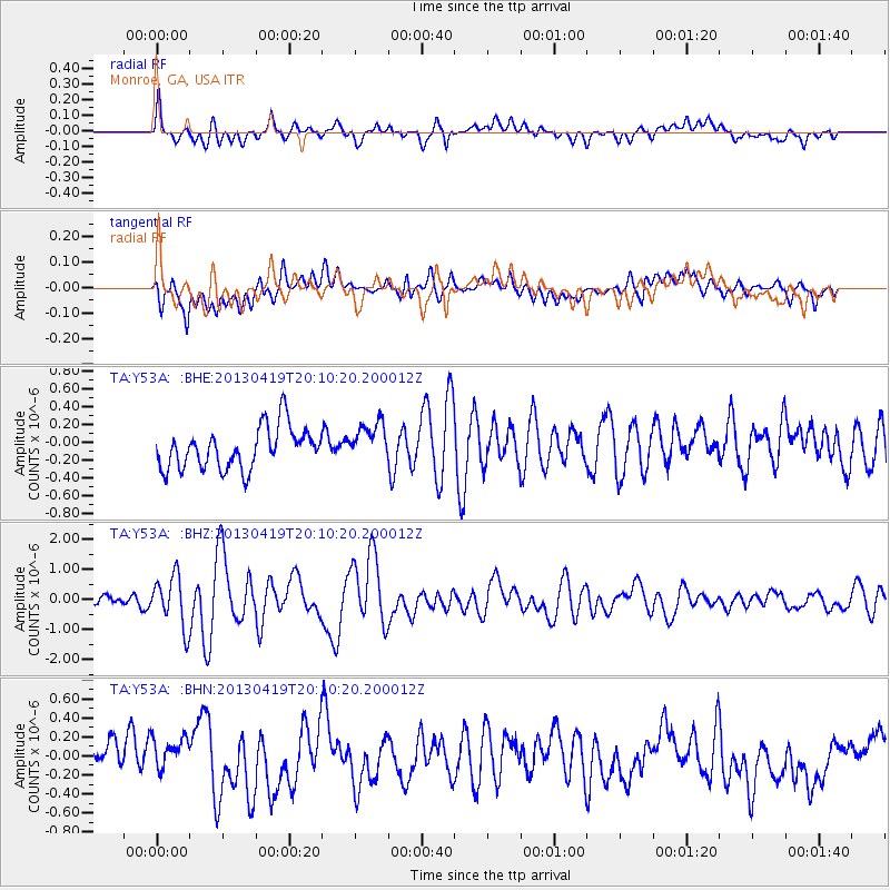
Y53A Monroe, GA, USA - Earthquake Result Viewer
*The percent match for this event was below the threshold and hence no stack was calculated.
| Earthquake location: |
East Of Kuril Islands |
| Earthquake latitude/longitude: |
50.0/157.7 |
| Earthquake time(UTC): |
2013/04/19 (109) 19:58:40 GMT |
| Earthquake Depth: |
15 km |
| Earthquake Magnitude: |
6.1 MW, 5.9 MB, 6.0 MW, 6.1 MS |
| Earthquake Catalog/Contributor: |
NEIC PDE/NEIC PDE-W |
|
| Network: |
TA USArray Transportable Network (new EarthScope stations) |
| Station: |
Y53A Monroe, GA, USA |
| Lat/Lon: |
33.86 N/83.58 W |
| Elevation: |
234 m |
|
| Distance: |
80.5 deg |
| Az: |
47.697 deg |
| Baz: |
324.974 deg |
| Ray Param: |
$rayparam |
*The percent match for this event was below the threshold and hence was not used in the summary stack. |
|
| Radial Match: |
65.02834 % |
| Radial Bump: |
400 |
| Transverse Match: |
56.025604 % |
| Transverse Bump: |
400 |
| SOD ConfigId: |
512894 |
| Insert Time: |
2013-09-13 13:05:03.769 +0000 |
| GWidth: |
2.5 |
| Max Bumps: |
400 |
| Tol: |
0.001 |
|
Signal To Noise
| Channel | StoN | STA | LTA |
| TA:Y53A: :BHZ:20130419T20:10:20.200012Z | 3.4945717 | 8.464467E-7 | 2.4221757E-7 |
| TA:Y53A: :BHN:20130419T20:10:20.200012Z | 1.0085636 | 1.6370808E-7 | 1.6231806E-7 |
| TA:Y53A: :BHE:20130419T20:10:20.200012Z | 0.9776685 | 2.2349128E-7 | 2.2859616E-7 |
| Arrivals |
| Ps | |
| PpPs | |
| PsPs/PpSs | |


