You are here: Home > Network List > US - United States National Seismic Network Stations List
> Station COWI Conover, Wisconsin, USA > Earthquake Result Viewer
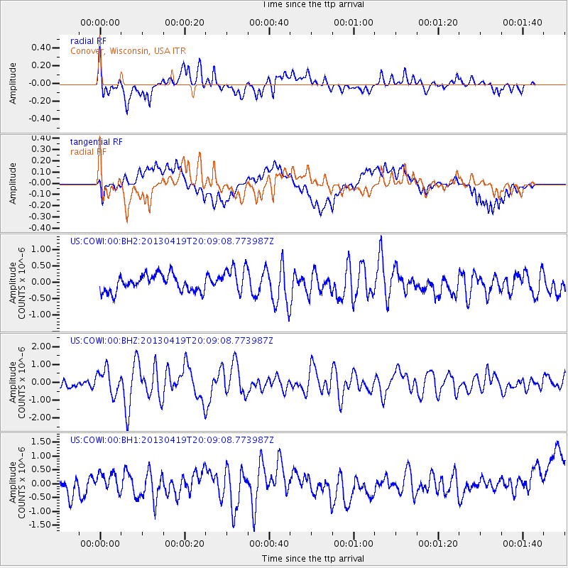
COWI Conover, Wisconsin, USA - Earthquake Result Viewer
*The percent match for this event was below the threshold and hence no stack was calculated.
| Earthquake location: |
East Of Kuril Islands |
| Earthquake latitude/longitude: |
50.0/157.7 |
| Earthquake time(UTC): |
2013/04/19 (109) 19:58:40 GMT |
| Earthquake Depth: |
15 km |
| Earthquake Magnitude: |
6.1 MW, 5.9 MB, 6.0 MW, 6.1 MS |
| Earthquake Catalog/Contributor: |
NEIC PDE/NEIC PDE-W |
|
| Network: |
US United States National Seismic Network |
| Station: |
COWI Conover, Wisconsin, USA |
| Lat/Lon: |
46.10 N/89.14 W |
| Elevation: |
523 m |
|
| Distance: |
68.2 deg |
| Az: |
43.529 deg |
| Baz: |
320.267 deg |
| Ray Param: |
$rayparam |
*The percent match for this event was below the threshold and hence was not used in the summary stack. |
|
| Radial Match: |
70.145836 % |
| Radial Bump: |
400 |
| Transverse Match: |
46.319366 % |
| Transverse Bump: |
400 |
| SOD ConfigId: |
512894 |
| Insert Time: |
2013-09-13 13:06:59.459 +0000 |
| GWidth: |
2.5 |
| Max Bumps: |
400 |
| Tol: |
0.001 |
|
Signal To Noise
| Channel | StoN | STA | LTA |
| US:COWI:00:BHZ:20130419T20:09:08.773987Z | 3.5265787 | 6.9271067E-7 | 1.9642569E-7 |
| US:COWI:00:BH1:20130419T20:09:08.773987Z | 1.0284754 | 3.3607714E-7 | 3.2677215E-7 |
| US:COWI:00:BH2:20130419T20:09:08.773987Z | 1.7305595 | 4.3091208E-7 | 2.490016E-7 |
| Arrivals |
| Ps | |
| PpPs | |
| PsPs/PpSs | |


