You are here: Home > Network List > US - United States National Seismic Network Stations List
> Station ERPA Erie, Pennsylvania, USA > Earthquake Result Viewer
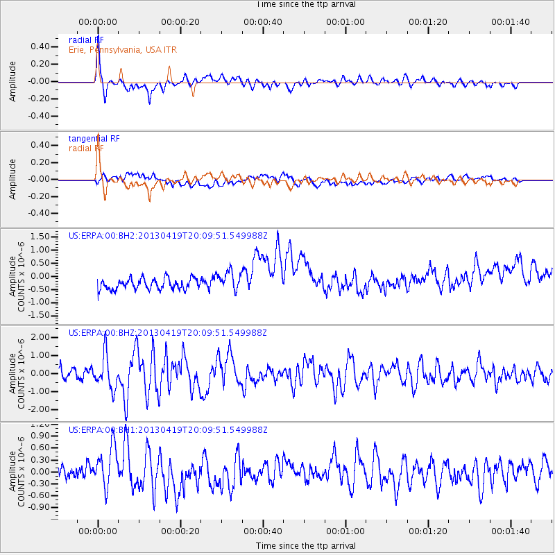
ERPA Erie, Pennsylvania, USA - Earthquake Result Viewer
*The percent match for this event was below the threshold and hence no stack was calculated.
| Earthquake location: |
East Of Kuril Islands |
| Earthquake latitude/longitude: |
50.0/157.7 |
| Earthquake time(UTC): |
2013/04/19 (109) 19:58:40 GMT |
| Earthquake Depth: |
15 km |
| Earthquake Magnitude: |
6.1 MW, 5.9 MB, 6.0 MW, 6.1 MS |
| Earthquake Catalog/Contributor: |
NEIC PDE/NEIC PDE-W |
|
| Network: |
US United States National Seismic Network |
| Station: |
ERPA Erie, Pennsylvania, USA |
| Lat/Lon: |
42.12 N/79.99 W |
| Elevation: |
306 m |
|
| Distance: |
75.3 deg |
| Az: |
40.512 deg |
| Baz: |
325.678 deg |
| Ray Param: |
$rayparam |
*The percent match for this event was below the threshold and hence was not used in the summary stack. |
|
| Radial Match: |
68.997116 % |
| Radial Bump: |
400 |
| Transverse Match: |
23.905128 % |
| Transverse Bump: |
400 |
| SOD ConfigId: |
512894 |
| Insert Time: |
2013-09-13 13:07:15.319 +0000 |
| GWidth: |
2.5 |
| Max Bumps: |
400 |
| Tol: |
0.001 |
|
Signal To Noise
| Channel | StoN | STA | LTA |
| US:ERPA:00:BHZ:20130419T20:09:51.549988Z | 3.9994187 | 9.5315016E-7 | 2.3832217E-7 |
| US:ERPA:00:BH1:20130419T20:09:51.549988Z | 3.5525994 | 5.4111587E-7 | 1.5231548E-7 |
| US:ERPA:00:BH2:20130419T20:09:51.549988Z | 1.8552252 | 3.7795655E-7 | 2.0372542E-7 |
| Arrivals |
| Ps | |
| PpPs | |
| PsPs/PpSs | |


