You are here: Home > Network List > US - United States National Seismic Network Stations List
> Station NATX Nacogdoches, Texas, USA > Earthquake Result Viewer
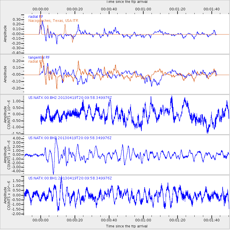
NATX Nacogdoches, Texas, USA - Earthquake Result Viewer
*The percent match for this event was below the threshold and hence no stack was calculated.
| Earthquake location: |
East Of Kuril Islands |
| Earthquake latitude/longitude: |
50.0/157.7 |
| Earthquake time(UTC): |
2013/04/19 (109) 19:58:40 GMT |
| Earthquake Depth: |
15 km |
| Earthquake Magnitude: |
6.1 MW, 5.9 MB, 6.0 MW, 6.1 MS |
| Earthquake Catalog/Contributor: |
NEIC PDE/NEIC PDE-W |
|
| Network: |
US United States National Seismic Network |
| Station: |
NATX Nacogdoches, Texas, USA |
| Lat/Lon: |
31.76 N/94.66 W |
| Elevation: |
156 m |
|
| Distance: |
76.5 deg |
| Az: |
56.564 deg |
| Baz: |
320.755 deg |
| Ray Param: |
$rayparam |
*The percent match for this event was below the threshold and hence was not used in the summary stack. |
|
| Radial Match: |
70.98073 % |
| Radial Bump: |
400 |
| Transverse Match: |
51.85305 % |
| Transverse Bump: |
400 |
| SOD ConfigId: |
512894 |
| Insert Time: |
2013-09-13 13:08:03.901 +0000 |
| GWidth: |
2.5 |
| Max Bumps: |
400 |
| Tol: |
0.001 |
|
Signal To Noise
| Channel | StoN | STA | LTA |
| US:NATX:00:BHZ:20130419T20:09:58.349976Z | 4.244755 | 8.298772E-7 | 1.9550652E-7 |
| US:NATX:00:BH1:20130419T20:09:58.349976Z | 0.98278224 | 3.1389098E-7 | 3.1939018E-7 |
| US:NATX:00:BH2:20130419T20:09:58.349976Z | 1.1572815 | 3.6270453E-7 | 3.134108E-7 |
| Arrivals |
| Ps | |
| PpPs | |
| PsPs/PpSs | |


