You are here: Home > Network List > CN - Canadian National Seismograph Network Stations List
> Station INK INUVIK, NT > Earthquake Result Viewer
INK INUVIK, NT - Earthquake Result Viewer
*The percent match for this event was below the threshold and hence no stack was calculated.
| Earthquake location: |
New Britain Region, P.N.G. |
| Earthquake latitude/longitude: |
-5.0/152.1 |
| Earthquake time(UTC): |
2013/04/20 (110) 03:42:02 GMT |
| Earthquake Depth: |
65 km |
| Earthquake Magnitude: |
5.6 MW, 5.6 MB, 5.7 MW |
| Earthquake Catalog/Contributor: |
NEIC PDE/NEIC PDE-W |
|
| Network: |
CN Canadian National Seismograph Network |
| Station: |
INK INUVIK, NT |
| Lat/Lon: |
68.31 N/133.53 W |
| Elevation: |
44 m |
|
| Distance: |
88.9 deg |
| Az: |
20.983 deg |
| Baz: |
253.649 deg |
| Ray Param: |
$rayparam |
*The percent match for this event was below the threshold and hence was not used in the summary stack. |
|
| Radial Match: |
60.59482 % |
| Radial Bump: |
400 |
| Transverse Match: |
52.93151 % |
| Transverse Bump: |
400 |
| SOD ConfigId: |
512894 |
| Insert Time: |
2013-09-13 13:44:17.585 +0000 |
| GWidth: |
2.5 |
| Max Bumps: |
400 |
| Tol: |
0.001 |
|
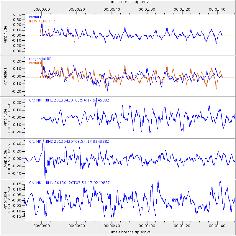
Signal To Noise
| Channel | StoN | STA | LTA |
| CN:INK: :BHZ:20130420T03:54:17.924988Z | 4.249124 | 2.7846085E-7 | 6.5533705E-8 |
| CN:INK: :BHN:20130420T03:54:17.924988Z | 1.2568682 | 6.451021E-8 | 5.1326154E-8 |
| CN:INK: :BHE:20130420T03:54:17.924988Z | 2.443474 | 1.10729516E-7 | 4.531643E-8 |
| Arrivals |
| Ps | |
| PpPs | |
| PsPs/PpSs | |


