You are here: Home > Network List > TA - USArray Transportable Network (new EarthScope stations) Stations List
> Station Z49A Columbiana, AL, USA > Earthquake Result Viewer
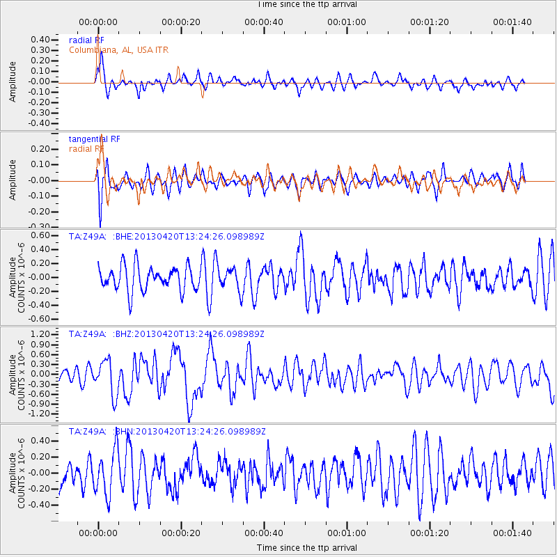
Z49A Columbiana, AL, USA - Earthquake Result Viewer
*The percent match for this event was below the threshold and hence no stack was calculated.
| Earthquake location: |
Kuril Islands |
| Earthquake latitude/longitude: |
50.1/157.1 |
| Earthquake time(UTC): |
2013/04/20 (110) 13:12:50 GMT |
| Earthquake Depth: |
18 km |
| Earthquake Magnitude: |
6.1 MW, 5.8 MB, 5.9 MS, 6.0 MW |
| Earthquake Catalog/Contributor: |
NEIC PDE/NEIC PDE-W |
|
| Network: |
TA USArray Transportable Network (new EarthScope stations) |
| Station: |
Z49A Columbiana, AL, USA |
| Lat/Lon: |
33.19 N/86.53 W |
| Elevation: |
134 m |
|
| Distance: |
79.8 deg |
| Az: |
49.79 deg |
| Baz: |
324.088 deg |
| Ray Param: |
$rayparam |
*The percent match for this event was below the threshold and hence was not used in the summary stack. |
|
| Radial Match: |
73.89165 % |
| Radial Bump: |
400 |
| Transverse Match: |
68.7592 % |
| Transverse Bump: |
400 |
| SOD ConfigId: |
512894 |
| Insert Time: |
2013-09-13 15:08:46.620 +0000 |
| GWidth: |
2.5 |
| Max Bumps: |
400 |
| Tol: |
0.001 |
|
Signal To Noise
| Channel | StoN | STA | LTA |
| TA:Z49A: :BHZ:20130420T13:24:26.098989Z | 2.3970284 | 5.445539E-7 | 2.2717875E-7 |
| TA:Z49A: :BHN:20130420T13:24:26.098989Z | 1.8021711 | 2.8660438E-7 | 1.5903284E-7 |
| TA:Z49A: :BHE:20130420T13:24:26.098989Z | 0.92999285 | 1.6233228E-7 | 1.7455217E-7 |
| Arrivals |
| Ps | |
| PpPs | |
| PsPs/PpSs | |


