You are here: Home > Network List > US - United States National Seismic Network Stations List
> Station NATX Nacogdoches, Texas, USA > Earthquake Result Viewer
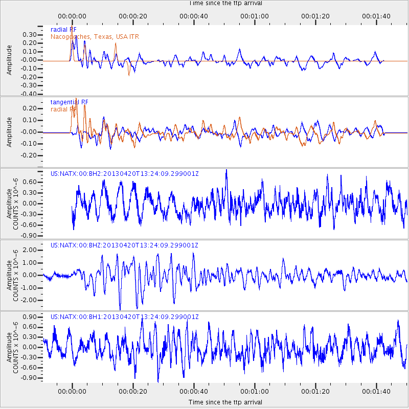
NATX Nacogdoches, Texas, USA - Earthquake Result Viewer
*The percent match for this event was below the threshold and hence no stack was calculated.
| Earthquake location: |
Kuril Islands |
| Earthquake latitude/longitude: |
50.1/157.1 |
| Earthquake time(UTC): |
2013/04/20 (110) 13:12:50 GMT |
| Earthquake Depth: |
18 km |
| Earthquake Magnitude: |
6.1 MW, 5.8 MB, 5.9 MS, 6.0 MW |
| Earthquake Catalog/Contributor: |
NEIC PDE/NEIC PDE-W |
|
| Network: |
US United States National Seismic Network |
| Station: |
NATX Nacogdoches, Texas, USA |
| Lat/Lon: |
31.76 N/94.66 W |
| Elevation: |
156 m |
|
| Distance: |
76.7 deg |
| Az: |
56.248 deg |
| Baz: |
321.054 deg |
| Ray Param: |
$rayparam |
*The percent match for this event was below the threshold and hence was not used in the summary stack. |
|
| Radial Match: |
78.01514 % |
| Radial Bump: |
400 |
| Transverse Match: |
41.554966 % |
| Transverse Bump: |
400 |
| SOD ConfigId: |
512894 |
| Insert Time: |
2013-09-13 15:11:38.798 +0000 |
| GWidth: |
2.5 |
| Max Bumps: |
400 |
| Tol: |
0.001 |
|
Signal To Noise
| Channel | StoN | STA | LTA |
| US:NATX:00:BHZ:20130420T13:24:09.299001Z | 2.2231758 | 4.2111438E-7 | 1.8942019E-7 |
| US:NATX:00:BH1:20130420T13:24:09.299001Z | 1.0469872 | 2.716012E-7 | 2.5941216E-7 |
| US:NATX:00:BH2:20130420T13:24:09.299001Z | 0.7592446 | 2.5249813E-7 | 3.3256492E-7 |
| Arrivals |
| Ps | |
| PpPs | |
| PsPs/PpSs | |


