You are here: Home > Network List > TA - USArray Transportable Network (new EarthScope stations) Stations List
> Station A21K Barrow, AK, USA > Earthquake Result Viewer
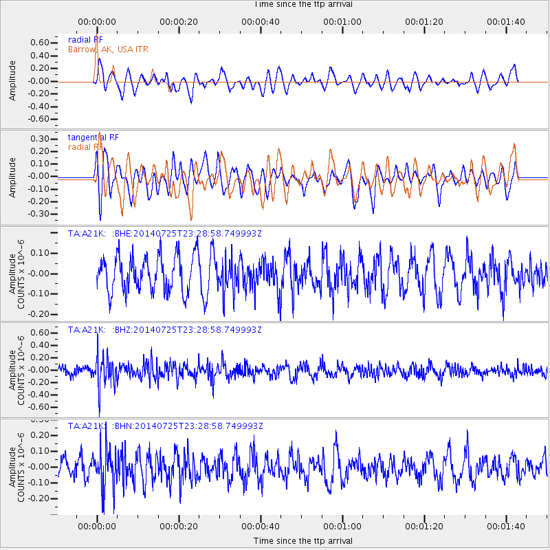
A21K Barrow, AK, USA - Earthquake Result Viewer
*The percent match for this event was below the threshold and hence no stack was calculated.
| Earthquake location: |
Kuril Islands |
| Earthquake latitude/longitude: |
43.5/147.3 |
| Earthquake time(UTC): |
2014/07/25 (206) 23:22:10 GMT |
| Earthquake Depth: |
62 km |
| Earthquake Magnitude: |
5.0 MW, 5.1 mb |
| Earthquake Catalog/Contributor: |
ISC/ISC |
|
| Network: |
TA USArray Transportable Network (new EarthScope stations) |
| Station: |
A21K Barrow, AK, USA |
| Lat/Lon: |
71.32 N/156.62 W |
| Elevation: |
577 m |
|
| Distance: |
38.7 deg |
| Az: |
25.284 deg |
| Baz: |
254.827 deg |
| Ray Param: |
$rayparam |
*The percent match for this event was below the threshold and hence was not used in the summary stack. |
|
| Radial Match: |
52.511147 % |
| Radial Bump: |
400 |
| Transverse Match: |
66.01594 % |
| Transverse Bump: |
400 |
| SOD ConfigId: |
3390531 |
| Insert Time: |
2019-04-13 01:09:07.497 +0000 |
| GWidth: |
2.5 |
| Max Bumps: |
400 |
| Tol: |
0.001 |
|
Signal To Noise
| Channel | StoN | STA | LTA |
| TA:A21K: :BHZ:20140725T23:28:58.749993Z | 3.5973976 | 2.4355364E-7 | 6.7702736E-8 |
| TA:A21K: :BHN:20140725T23:28:58.749993Z | 2.2686632 | 1.2295702E-7 | 5.4198008E-8 |
| TA:A21K: :BHE:20140725T23:28:58.749993Z | 0.9109943 | 7.888359E-8 | 8.6590646E-8 |
| Arrivals |
| Ps | |
| PpPs | |
| PsPs/PpSs | |


