You are here: Home > Network List > X812 - Deep Structure of Three Continental Sutures in Eastern North America Stations List
> Station QM20 Hay Lake, Maine, USA > Earthquake Result Viewer
QM20 Hay Lake, Maine, USA - Earthquake Result Viewer
*The percent match for this event was below the threshold and hence no stack was calculated.
| Earthquake location: |
Kuril Islands |
| Earthquake latitude/longitude: |
43.5/147.3 |
| Earthquake time(UTC): |
2014/07/25 (206) 23:22:10 GMT |
| Earthquake Depth: |
62 km |
| Earthquake Magnitude: |
5.0 MW, 5.1 mb |
| Earthquake Catalog/Contributor: |
ISC/ISC |
|
| Network: |
X8 Deep Structure of Three Continental Sutures in Eastern North America |
| Station: |
QM20 Hay Lake, Maine, USA |
| Lat/Lon: |
46.13 N/68.72 W |
| Elevation: |
207 m |
|
| Distance: |
85.2 deg |
| Az: |
24.237 deg |
| Baz: |
334.549 deg |
| Ray Param: |
$rayparam |
*The percent match for this event was below the threshold and hence was not used in the summary stack. |
|
| Radial Match: |
50.58071 % |
| Radial Bump: |
400 |
| Transverse Match: |
49.581398 % |
| Transverse Bump: |
400 |
| SOD ConfigId: |
3390531 |
| Insert Time: |
2019-04-13 01:11:14.849 +0000 |
| GWidth: |
2.5 |
| Max Bumps: |
400 |
| Tol: |
0.001 |
|
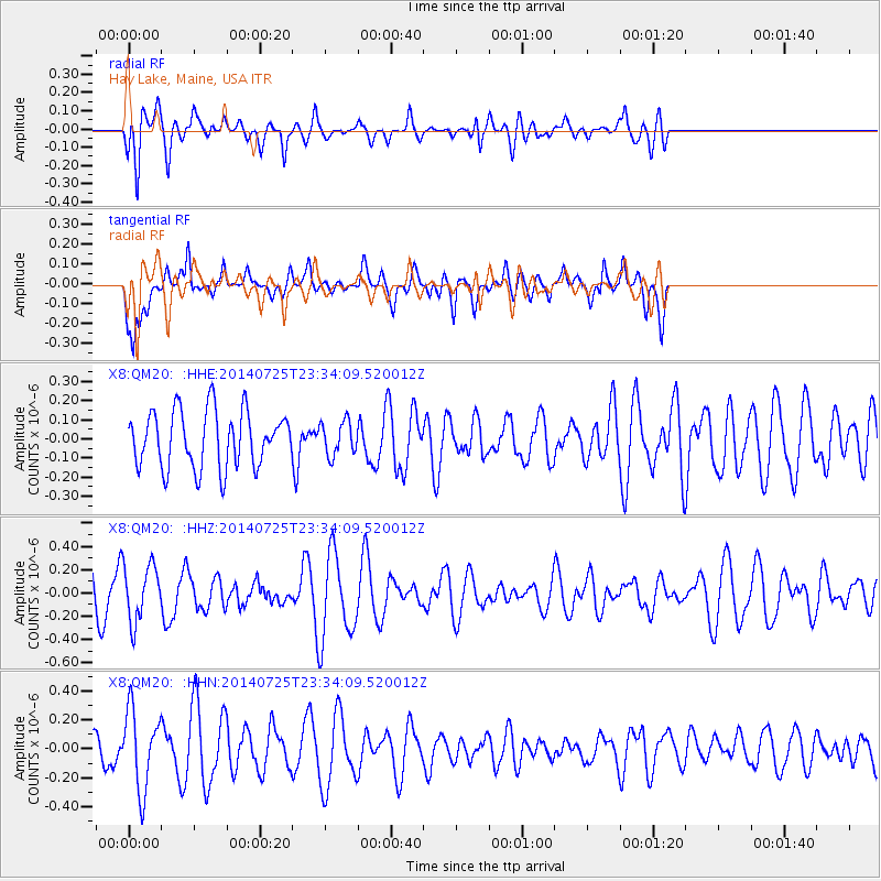
Signal To Noise
| Channel | StoN | STA | LTA |
| X8:QM20: :HHZ:20140725T23:34:09.520012Z | 1.4359369 | 2.4285808E-7 | 1.6912865E-7 |
| X8:QM20: :HHN:20140725T23:34:09.520012Z | 3.0434413 | 2.7045365E-7 | 8.8864425E-8 |
| X8:QM20: :HHE:20140725T23:34:09.520012Z | 0.5956405 | 8.75129E-8 | 1.4692236E-7 |
| Arrivals |
| Ps | |
| PpPs | |
| PsPs/PpSs | |


