You are here: Home > Network List > CN - Canadian National Seismograph Network Stations List
> Station FRB IQALUIT, N.W.T. > Earthquake Result Viewer
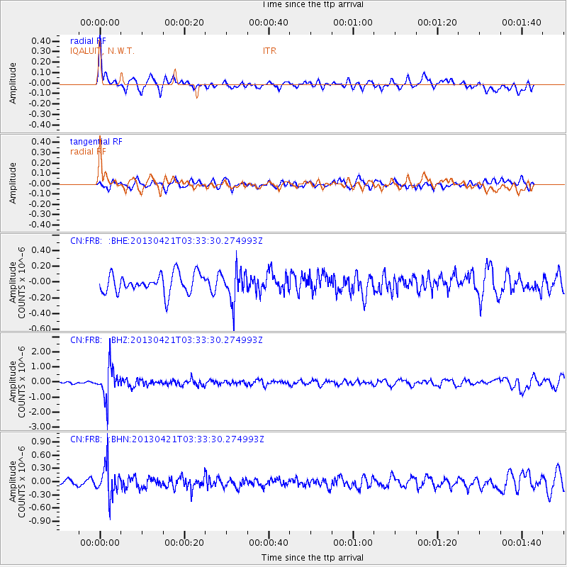
FRB IQALUIT, N.W.T. - Earthquake Result Viewer
*The percent match for this event was below the threshold and hence no stack was calculated.
| Earthquake location: |
Southeast Of Honshu, Japan |
| Earthquake latitude/longitude: |
29.9/138.9 |
| Earthquake time(UTC): |
2013/04/21 (111) 03:22:16 GMT |
| Earthquake Depth: |
422 km |
| Earthquake Magnitude: |
6.1 MW, 5.7 MB, 6.1 MW |
| Earthquake Catalog/Contributor: |
NEIC PDE/NEIC PDE-W |
|
| Network: |
CN Canadian National Seismograph Network |
| Station: |
FRB IQALUIT, N.W.T. |
| Lat/Lon: |
63.75 N/68.55 W |
| Elevation: |
18 m |
|
| Distance: |
84.1 deg |
| Az: |
11.886 deg |
| Baz: |
336.295 deg |
| Ray Param: |
$rayparam |
*The percent match for this event was below the threshold and hence was not used in the summary stack. |
|
| Radial Match: |
69.71627 % |
| Radial Bump: |
400 |
| Transverse Match: |
46.49858 % |
| Transverse Bump: |
400 |
| SOD ConfigId: |
512894 |
| Insert Time: |
2013-09-13 15:29:22.486 +0000 |
| GWidth: |
2.5 |
| Max Bumps: |
400 |
| Tol: |
0.001 |
|
Signal To Noise
| Channel | StoN | STA | LTA |
| CN:FRB: :BHZ:20130421T03:33:30.274993Z | 10.962787 | 1.0541706E-6 | 9.6159E-8 |
| CN:FRB: :BHN:20130421T03:33:30.274993Z | 3.8715315 | 3.5259455E-7 | 9.107366E-8 |
| CN:FRB: :BHE:20130421T03:33:30.274993Z | 1.5503863 | 1.8781228E-7 | 1.2113901E-7 |
| Arrivals |
| Ps | |
| PpPs | |
| PsPs/PpSs | |


