You are here: Home > Network List > TA - USArray Transportable Network (new EarthScope stations) Stations List
> Station D41A Chassel, MI, USA > Earthquake Result Viewer
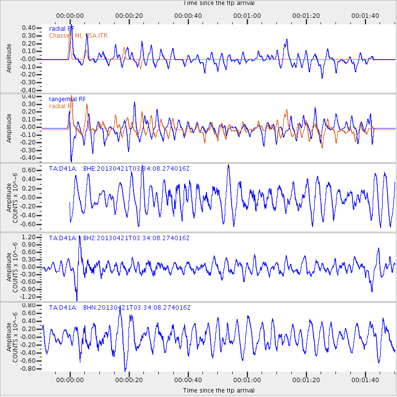
D41A Chassel, MI, USA - Earthquake Result Viewer
*The percent match for this event was below the threshold and hence no stack was calculated.
| Earthquake location: |
Southeast Of Honshu, Japan |
| Earthquake latitude/longitude: |
29.9/138.9 |
| Earthquake time(UTC): |
2013/04/21 (111) 03:22:16 GMT |
| Earthquake Depth: |
422 km |
| Earthquake Magnitude: |
6.1 MW, 5.7 MB, 6.1 MW |
| Earthquake Catalog/Contributor: |
NEIC PDE/NEIC PDE-W |
|
| Network: |
TA USArray Transportable Network (new EarthScope stations) |
| Station: |
D41A Chassel, MI, USA |
| Lat/Lon: |
47.06 N/88.57 W |
| Elevation: |
271 m |
|
| Distance: |
92.2 deg |
| Az: |
30.269 deg |
| Baz: |
320.208 deg |
| Ray Param: |
$rayparam |
*The percent match for this event was below the threshold and hence was not used in the summary stack. |
|
| Radial Match: |
54.556797 % |
| Radial Bump: |
366 |
| Transverse Match: |
60.13565 % |
| Transverse Bump: |
400 |
| SOD ConfigId: |
512894 |
| Insert Time: |
2013-09-13 15:50:52.780 +0000 |
| GWidth: |
2.5 |
| Max Bumps: |
400 |
| Tol: |
0.001 |
|
Signal To Noise
| Channel | StoN | STA | LTA |
| TA:D41A: :BHZ:20130421T03:34:08.274016Z | 4.1120195 | 5.8581054E-7 | 1.4246298E-7 |
| TA:D41A: :BHN:20130421T03:34:08.274016Z | 0.7502588 | 2.1419748E-7 | 2.8549812E-7 |
| TA:D41A: :BHE:20130421T03:34:08.274016Z | 0.7730408 | 2.2193468E-7 | 2.8709312E-7 |
| Arrivals |
| Ps | |
| PpPs | |
| PsPs/PpSs | |


