You are here: Home > Network List > TA - USArray Transportable Network (new EarthScope stations) Stations List
> Station F41A Wisconsin Rapids, WI, USA > Earthquake Result Viewer
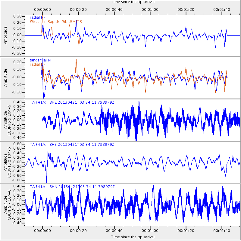
F41A Wisconsin Rapids, WI, USA - Earthquake Result Viewer
*The percent match for this event was below the threshold and hence no stack was calculated.
| Earthquake location: |
Southeast Of Honshu, Japan |
| Earthquake latitude/longitude: |
29.9/138.9 |
| Earthquake time(UTC): |
2013/04/21 (111) 03:22:16 GMT |
| Earthquake Depth: |
422 km |
| Earthquake Magnitude: |
6.1 MW, 5.7 MB, 6.1 MW |
| Earthquake Catalog/Contributor: |
NEIC PDE/NEIC PDE-W |
|
| Network: |
TA USArray Transportable Network (new EarthScope stations) |
| Station: |
F41A Wisconsin Rapids, WI, USA |
| Lat/Lon: |
45.74 N/89.10 W |
| Elevation: |
509 m |
|
| Distance: |
93.0 deg |
| Az: |
31.406 deg |
| Baz: |
319.767 deg |
| Ray Param: |
$rayparam |
*The percent match for this event was below the threshold and hence was not used in the summary stack. |
|
| Radial Match: |
50.9896 % |
| Radial Bump: |
400 |
| Transverse Match: |
60.065918 % |
| Transverse Bump: |
400 |
| SOD ConfigId: |
512894 |
| Insert Time: |
2013-09-13 15:57:18.629 +0000 |
| GWidth: |
2.5 |
| Max Bumps: |
400 |
| Tol: |
0.001 |
|
Signal To Noise
| Channel | StoN | STA | LTA |
| TA:F41A: :BHZ:20130421T03:34:11.798979Z | 2.4054027 | 2.695759E-7 | 1.1207101E-7 |
| TA:F41A: :BHN:20130421T03:34:11.798979Z | 0.9866128 | 1.1337459E-7 | 1.1491295E-7 |
| TA:F41A: :BHE:20130421T03:34:11.798979Z | 1.2197341 | 1.18063795E-7 | 9.67947E-8 |
| Arrivals |
| Ps | |
| PpPs | |
| PsPs/PpSs | |


