You are here: Home > Network List > TA - USArray Transportable Network (new EarthScope stations) Stations List
> Station G05D Wamic, OR, USA > Earthquake Result Viewer
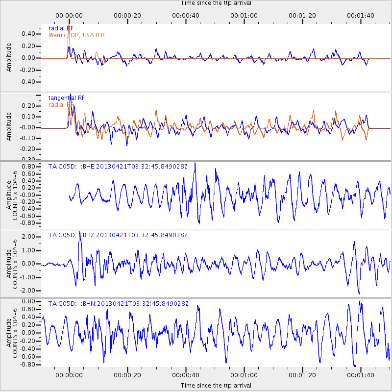
G05D Wamic, OR, USA - Earthquake Result Viewer
*The percent match for this event was below the threshold and hence no stack was calculated.
| Earthquake location: |
Southeast Of Honshu, Japan |
| Earthquake latitude/longitude: |
29.9/138.9 |
| Earthquake time(UTC): |
2013/04/21 (111) 03:22:16 GMT |
| Earthquake Depth: |
422 km |
| Earthquake Magnitude: |
6.1 MW, 5.7 MB, 6.1 MW |
| Earthquake Catalog/Contributor: |
NEIC PDE/NEIC PDE-W |
|
| Network: |
TA USArray Transportable Network (new EarthScope stations) |
| Station: |
G05D Wamic, OR, USA |
| Lat/Lon: |
45.24 N/121.32 W |
| Elevation: |
592 m |
|
| Distance: |
75.7 deg |
| Az: |
45.927 deg |
| Baz: |
298.024 deg |
| Ray Param: |
$rayparam |
*The percent match for this event was below the threshold and hence was not used in the summary stack. |
|
| Radial Match: |
57.559265 % |
| Radial Bump: |
400 |
| Transverse Match: |
41.43157 % |
| Transverse Bump: |
400 |
| SOD ConfigId: |
512894 |
| Insert Time: |
2013-09-13 15:59:15.831 +0000 |
| GWidth: |
2.5 |
| Max Bumps: |
400 |
| Tol: |
0.001 |
|
Signal To Noise
| Channel | StoN | STA | LTA |
| TA:G05D: :BHZ:20130421T03:32:45.849028Z | 5.6197143 | 1.0177951E-6 | 1.8111153E-7 |
| TA:G05D: :BHN:20130421T03:32:45.849028Z | 1.0354246 | 2.6023318E-7 | 2.513299E-7 |
| TA:G05D: :BHE:20130421T03:32:45.849028Z | 1.2799844 | 2.422488E-7 | 1.892592E-7 |
| Arrivals |
| Ps | |
| PpPs | |
| PsPs/PpSs | |


