You are here: Home > Network List > WY - Yellowstone Wyoming Seismic Network Stations List
> Station YUF Upper Falls, WY, USA > Earthquake Result Viewer
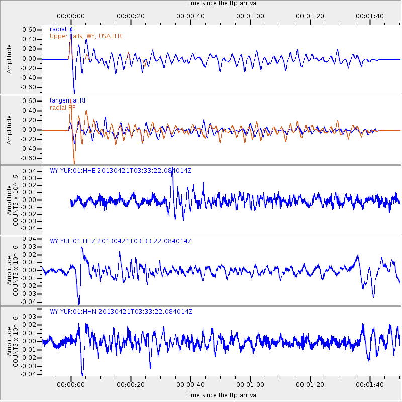
YUF Upper Falls, WY, USA - Earthquake Result Viewer
*The percent match for this event was below the threshold and hence no stack was calculated.
| Earthquake location: |
Southeast Of Honshu, Japan |
| Earthquake latitude/longitude: |
29.9/138.9 |
| Earthquake time(UTC): |
2013/04/21 (111) 03:22:16 GMT |
| Earthquake Depth: |
422 km |
| Earthquake Magnitude: |
6.1 MW, 5.7 MB, 6.1 MW |
| Earthquake Catalog/Contributor: |
NEIC PDE/NEIC PDE-W |
|
| Network: |
WY Yellowstone Wyoming Seismic Network |
| Station: |
YUF Upper Falls, WY, USA |
| Lat/Lon: |
44.71 N/110.51 W |
| Elevation: |
2394 m |
|
| Distance: |
82.5 deg |
| Az: |
42.311 deg |
| Baz: |
304.962 deg |
| Ray Param: |
$rayparam |
*The percent match for this event was below the threshold and hence was not used in the summary stack. |
|
| Radial Match: |
71.73733 % |
| Radial Bump: |
400 |
| Transverse Match: |
59.734818 % |
| Transverse Bump: |
400 |
| SOD ConfigId: |
512894 |
| Insert Time: |
2013-09-13 16:42:12.998 +0000 |
| GWidth: |
2.5 |
| Max Bumps: |
400 |
| Tol: |
0.001 |
|
Signal To Noise
| Channel | StoN | STA | LTA |
| WY:YUF:01:HHZ:20130421T03:33:22.084014Z | 5.998626 | 1.9566711E-8 | 3.2618652E-9 |
| WY:YUF:01:HHN:20130421T03:33:22.084014Z | 3.419993 | 1.5951645E-8 | 4.6642334E-9 |
| WY:YUF:01:HHE:20130421T03:33:22.084014Z | 3.6135201 | 1.5943716E-8 | 4.4122395E-9 |
| Arrivals |
| Ps | |
| PpPs | |
| PsPs/PpSs | |


