You are here: Home > Network List > AG - Arkansas Seismic Network Stations List
> Station LCAR Lake Charles,AR > Earthquake Result Viewer
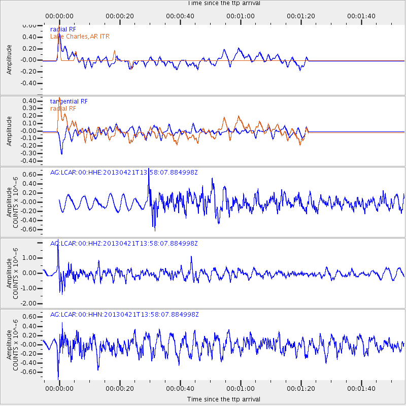
LCAR Lake Charles,AR - Earthquake Result Viewer
*The percent match for this event was below the threshold and hence no stack was calculated.
| Earthquake location: |
Andreanof Islands, Aleutian Is. |
| Earthquake latitude/longitude: |
51.7/-178.2 |
| Earthquake time(UTC): |
2013/04/21 (111) 13:48:29 GMT |
| Earthquake Depth: |
44 km |
| Earthquake Magnitude: |
5.6 MW, 5.7 MW, 5.9 MB |
| Earthquake Catalog/Contributor: |
NEIC PDE/NEIC PDE-W |
|
| Network: |
AG Arkansas Seismic Network |
| Station: |
LCAR Lake Charles,AR |
| Lat/Lon: |
36.07 N/91.15 W |
| Elevation: |
103 m |
|
| Distance: |
61.0 deg |
| Az: |
67.638 deg |
| Baz: |
314.686 deg |
| Ray Param: |
$rayparam |
*The percent match for this event was below the threshold and hence was not used in the summary stack. |
|
| Radial Match: |
68.88534 % |
| Radial Bump: |
400 |
| Transverse Match: |
72.977745 % |
| Transverse Bump: |
400 |
| SOD ConfigId: |
512894 |
| Insert Time: |
2013-09-13 16:47:50.230 +0000 |
| GWidth: |
2.5 |
| Max Bumps: |
400 |
| Tol: |
0.001 |
|
Signal To Noise
| Channel | StoN | STA | LTA |
| AG:LCAR:00:HHZ:20130421T13:58:07.884998Z | 3.1031604 | 6.204285E-7 | 1.9993439E-7 |
| AG:LCAR:00:HHN:20130421T13:58:07.884998Z | 2.2347124 | 2.2733929E-7 | 1.017309E-7 |
| AG:LCAR:00:HHE:20130421T13:58:07.884998Z | 2.1365938 | 2.450846E-7 | 1.147081E-7 |
| Arrivals |
| Ps | |
| PpPs | |
| PsPs/PpSs | |


