You are here: Home > Network List > KN - Kyrgyz Seismic Telemetry Network Stations List
> Station TKM2 - > Earthquake Result Viewer
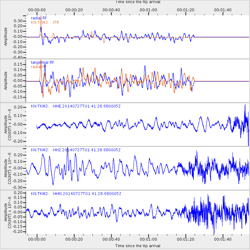
TKM2 - - Earthquake Result Viewer
*The percent match for this event was below the threshold and hence no stack was calculated.
| Earthquake location: |
Northern Mid-Atlantic Ridge |
| Earthquake latitude/longitude: |
23.8/-45.6 |
| Earthquake time(UTC): |
2014/07/27 (208) 01:28:38 GMT |
| Earthquake Depth: |
10 km |
| Earthquake Magnitude: |
5.6 MB, 6.0 MWB, 6.6 MI |
| Earthquake Catalog/Contributor: |
NEIC PDE/NEIC COMCAT |
|
| Network: |
KN Kyrgyz Seismic Telemetry Network |
| Station: |
TKM2 - |
| Lat/Lon: |
42.92 N/75.60 E |
| Elevation: |
2020 m |
|
| Distance: |
94.4 deg |
| Az: |
39.045 deg |
| Baz: |
308.214 deg |
| Ray Param: |
$rayparam |
*The percent match for this event was below the threshold and hence was not used in the summary stack. |
|
| Radial Match: |
48.787395 % |
| Radial Bump: |
400 |
| Transverse Match: |
66.639786 % |
| Transverse Bump: |
400 |
| SOD ConfigId: |
3390531 |
| Insert Time: |
2019-04-13 01:22:40.379 +0000 |
| GWidth: |
2.5 |
| Max Bumps: |
400 |
| Tol: |
0.001 |
|
Signal To Noise
| Channel | StoN | STA | LTA |
| KN:TKM2: :HHZ:20140727T01:41:28.680005Z | 2.909974 | 1.0789475E-7 | 3.7077562E-8 |
| KN:TKM2: :HHN:20140727T01:41:28.680005Z | 0.83543766 | 1.7673354E-8 | 2.1154605E-8 |
| KN:TKM2: :HHE:20140727T01:41:28.680005Z | 1.8263494 | 3.250132E-8 | 1.7795784E-8 |
| Arrivals |
| Ps | |
| PpPs | |
| PsPs/PpSs | |


