You are here: Home > Network List > NE - New England Seismic Network Stations List
> Station EMMW Machias, ME, USA > Earthquake Result Viewer
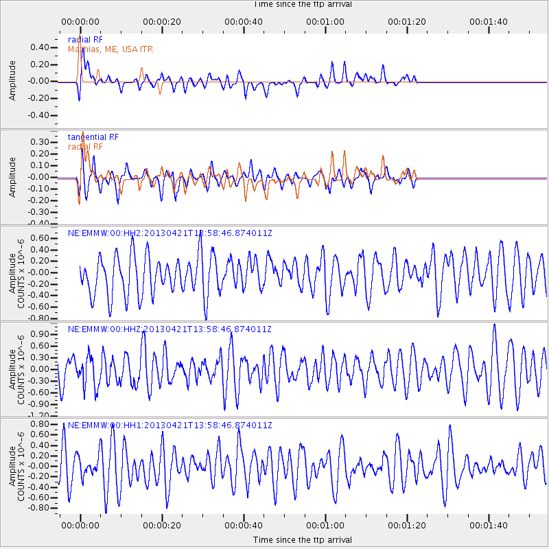
EMMW Machias, ME, USA - Earthquake Result Viewer
*The percent match for this event was below the threshold and hence no stack was calculated.
| Earthquake location: |
Andreanof Islands, Aleutian Is. |
| Earthquake latitude/longitude: |
51.7/-178.2 |
| Earthquake time(UTC): |
2013/04/21 (111) 13:48:29 GMT |
| Earthquake Depth: |
44 km |
| Earthquake Magnitude: |
5.6 MW, 5.7 MW, 5.9 MB |
| Earthquake Catalog/Contributor: |
NEIC PDE/NEIC PDE-W |
|
| Network: |
NE New England Seismic Network |
| Station: |
EMMW Machias, ME, USA |
| Lat/Lon: |
44.71 N/67.46 W |
| Elevation: |
35 m |
|
| Distance: |
67.0 deg |
| Az: |
46.411 deg |
| Baz: |
320.753 deg |
| Ray Param: |
$rayparam |
*The percent match for this event was below the threshold and hence was not used in the summary stack. |
|
| Radial Match: |
67.595764 % |
| Radial Bump: |
400 |
| Transverse Match: |
71.27218 % |
| Transverse Bump: |
400 |
| SOD ConfigId: |
512894 |
| Insert Time: |
2013-09-13 17:08:02.921 +0000 |
| GWidth: |
2.5 |
| Max Bumps: |
400 |
| Tol: |
0.001 |
|
Signal To Noise
| Channel | StoN | STA | LTA |
| NE:EMMW:00:HHZ:20130421T13:58:46.874011Z | 0.6457694 | 3.950957E-7 | 6.118216E-7 |
| NE:EMMW:00:HH1:20130421T13:58:46.874011Z | 0.5072013 | 1.8118514E-7 | 3.572253E-7 |
| NE:EMMW:00:HH2:20130421T13:58:46.874011Z | 1.3820194 | 4.4752542E-7 | 3.2381993E-7 |
| Arrivals |
| Ps | |
| PpPs | |
| PsPs/PpSs | |


