You are here: Home > Network List > TA - USArray Transportable Network (new EarthScope stations) Stations List
> Station 455A Stateville, GA, USA > Earthquake Result Viewer
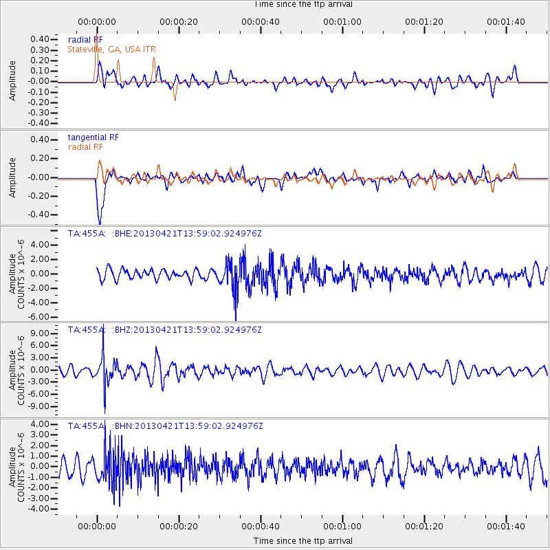
455A Stateville, GA, USA - Earthquake Result Viewer
*The percent match for this event was below the threshold and hence no stack was calculated.
| Earthquake location: |
Andreanof Islands, Aleutian Is. |
| Earthquake latitude/longitude: |
51.7/-178.2 |
| Earthquake time(UTC): |
2013/04/21 (111) 13:48:29 GMT |
| Earthquake Depth: |
44 km |
| Earthquake Magnitude: |
5.6 MW, 5.7 MW, 5.9 MB |
| Earthquake Catalog/Contributor: |
NEIC PDE/NEIC PDE-W |
|
| Network: |
TA USArray Transportable Network (new EarthScope stations) |
| Station: |
455A Stateville, GA, USA |
| Lat/Lon: |
30.74 N/83.03 W |
| Elevation: |
44 m |
|
| Distance: |
69.6 deg |
| Az: |
66.209 deg |
| Baz: |
318.552 deg |
| Ray Param: |
$rayparam |
*The percent match for this event was below the threshold and hence was not used in the summary stack. |
|
| Radial Match: |
64.3171 % |
| Radial Bump: |
400 |
| Transverse Match: |
62.465588 % |
| Transverse Bump: |
400 |
| SOD ConfigId: |
512894 |
| Insert Time: |
2013-09-13 17:18:00.970 +0000 |
| GWidth: |
2.5 |
| Max Bumps: |
400 |
| Tol: |
0.001 |
|
Signal To Noise
| Channel | StoN | STA | LTA |
| TA:455A: :BHZ:20130421T13:59:02.924976Z | 3.0541587 | 3.4295483E-6 | 1.1229109E-6 |
| TA:455A: :BHN:20130421T13:59:02.924976Z | 2.359857 | 1.5076351E-6 | 6.3886716E-7 |
| TA:455A: :BHE:20130421T13:59:02.924976Z | 2.9256837 | 1.9101828E-6 | 6.5290135E-7 |
| Arrivals |
| Ps | |
| PpPs | |
| PsPs/PpSs | |


