You are here: Home > Network List > TA - USArray Transportable Network (new EarthScope stations) Stations List
> Station D53A Lac Vacive, Pontiac, Mrc, QC, CAN > Earthquake Result Viewer
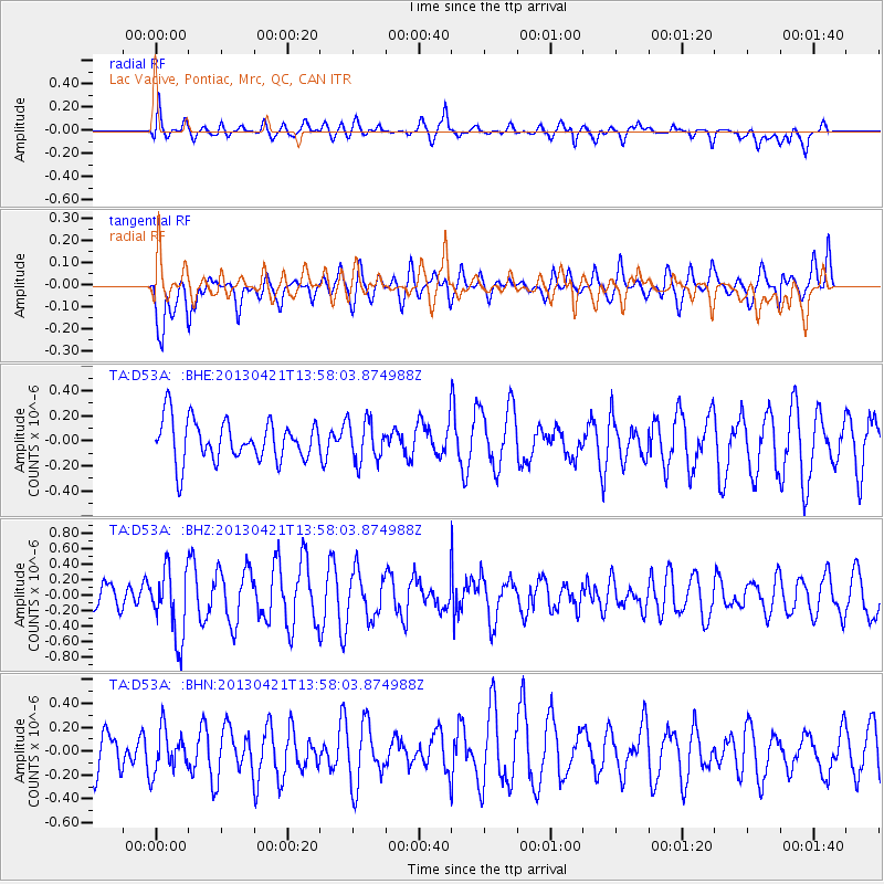
D53A Lac Vacive, Pontiac, Mrc, QC, CAN - Earthquake Result Viewer
*The percent match for this event was below the threshold and hence no stack was calculated.
| Earthquake location: |
Andreanof Islands, Aleutian Is. |
| Earthquake latitude/longitude: |
51.7/-178.2 |
| Earthquake time(UTC): |
2013/04/21 (111) 13:48:29 GMT |
| Earthquake Depth: |
44 km |
| Earthquake Magnitude: |
5.6 MW, 5.7 MW, 5.9 MB |
| Earthquake Catalog/Contributor: |
NEIC PDE/NEIC PDE-W |
|
| Network: |
TA USArray Transportable Network (new EarthScope stations) |
| Station: |
D53A Lac Vacive, Pontiac, Mrc, QC, CAN |
| Lat/Lon: |
47.08 N/77.70 W |
| Elevation: |
347 m |
|
| Distance: |
60.4 deg |
| Az: |
50.571 deg |
| Baz: |
315.256 deg |
| Ray Param: |
$rayparam |
*The percent match for this event was below the threshold and hence was not used in the summary stack. |
|
| Radial Match: |
63.522774 % |
| Radial Bump: |
400 |
| Transverse Match: |
60.345062 % |
| Transverse Bump: |
400 |
| SOD ConfigId: |
512894 |
| Insert Time: |
2013-09-13 17:19:46.598 +0000 |
| GWidth: |
2.5 |
| Max Bumps: |
400 |
| Tol: |
0.001 |
|
Signal To Noise
| Channel | StoN | STA | LTA |
| TA:D53A: :BHZ:20130421T13:58:03.874988Z | 2.1423934 | 4.4121728E-7 | 2.0594598E-7 |
| TA:D53A: :BHN:20130421T13:58:03.874988Z | 1.1244969 | 1.774492E-7 | 1.5780319E-7 |
| TA:D53A: :BHE:20130421T13:58:03.874988Z | 1.0105311 | 1.6493475E-7 | 1.632159E-7 |
| Arrivals |
| Ps | |
| PpPs | |
| PsPs/PpSs | |


